Omonville-la-Rogue geodata
Omonville-la-Rogue (Normandy) is a populated place; located in France in Europe/Paris (GMT+2) time zone. With population of 529 people, there are 14624 cities with bigger population in this country. Compared to other cities in France, 91.6% of cities are located further ↓South; 94.2% of cities are located further →East and 97% of cities have higher elevation than Omonville-la-Rogue. Note1
Administrative division(s):
- Level 1: Normandy
- Level 2: Manche
- Level 3: Arrondissement de Cherbourg
- Level 4: La Hague


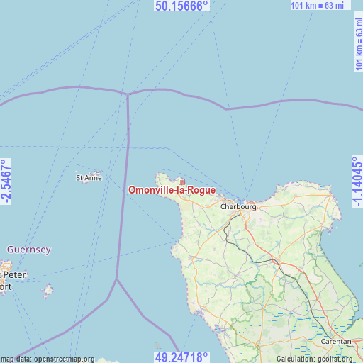
Omonville-la-Rogue GPS coordinates[2]
49° 42' 14.58" North, 1° 50' 36.852" West
| Map corner | latitude | longitude |
|---|---|---|
| Upper-left | 50.15666°, | -2.5467° |
| Center: | 49.70405°, | -1.84357° |
| Lower-right: | 49.24718°, | -1.14045° |
| Map W x H: | 101.1×101.1 km | = 62.8×62.8mi |
| max Lat: | 51.07786° ⇑8.4% North |
| Omonville-la-Rogue: | 49.70405° |
| min Lat: | ⇓91.6% South 41.3874° |
| min Long | Omonville-la-Ro | max Long |
| -5.08615° | -1.84357° | 9.52242° |
| W 5.8%⇐ | ⇒94.2% E |
Elevation
Elevation of Omonville-la-Rogue is 11 m = 36 ft, and this is 182.7 m = 599 ft below average elevation for this country.
| Max E: |
2333 m = 7654 ft | 97% |
| Avg. | 193.7 m = 635 ft | |
| Omonville-la-Rogue | 11 m = 36 ft | |
Min E: |
-1 m = -3 ft | 3% |
See also: France elevation on elevation.city.
Geographical zone
Omonville-la-Rogue is located in North temperate zone (between Tropic of Cancer and the Arctic Circle). Distance of this North polar circle is 1874.6 km =1164.8 mi to North.| Distance of | km | miles | from Omonville-la-Rogue |
|---|---|---|---|
| North Pole | 4480.5 | 2784.1 | to North |
| Arctic Circle | 1874.6 | 1164.8 | to North |
| Tropic Cancer | 2920.7 | 1814.8 | to South |
| Equator | 5526.6 | 3434.1 | to South |


Nearby cities:
15 places around Omonville-la-Rogue: (largest is in red/bold)
• Acqueville
12.6 km =7.8 mi,  147°
147°
• Beaumont-Hague
4.5 km =2.8 mi,  175°
175°
• Flottemanville-Hague
12.7 km =7.9 mi,  136°
136°
• Gréville-Hague
4.5 km =2.8 mi, 137°
• Nouainville
14.8 km =9.2 mi,  128°
128°
• Octeville
16.8 km =10.4 mi,  121°
121°
• Querqueville
11.9 km =7.4 mi,  112°
112°
• Sainte-Croix-Hague
8.9 km =5.5 mi, 145°
• Sideville
17.2 km =10.7 mi, 137°
• Teurthéville-Hague
15.8 km =9.8 mi, 148°
• Tonneville
11.5 km =7.1 mi, 126°
• Urville-Nacqueville
8.4 km =5.2 mi, 113°
• Vasteville
13.1 km =8.1 mi,  157°
157°
• Virandeville
17.2 km =10.7 mi, 150°
• Équeurdreville-Hainneville
15 km =9.3 mi, 114°
Sources, notices
• [Note1] Compared only with cities in France existing in our database
• [Src1] Map data: © OpenStreetMap contributors (CC-BY-SA)
• [Src2] Other city data from geonames.org with taken over terms of usage.
• [Src3] Geographical zone / Annual Mean Temperature by Robert A. Rohde @ Wikipedia
