Obersaasheim geodata
Obersaasheim (Grand Est) is a populated place; located in France in Europe/Paris (GMT+2) time zone. With population of 843 people, there are 10148 cities with bigger population in this country. Compared to other cities in France, 59% of cities are located further ↓South; 98.4% of cities are located further ←West and 65.2% of cities have lower elevation than Obersaasheim. Note1
Administrative division(s):
- Level 1: Grand Est
- Level 2: Haut-Rhin
- Level 3: Arrondissement de Colmar-Ribeauvillé
- Level 4: Obersaasheim


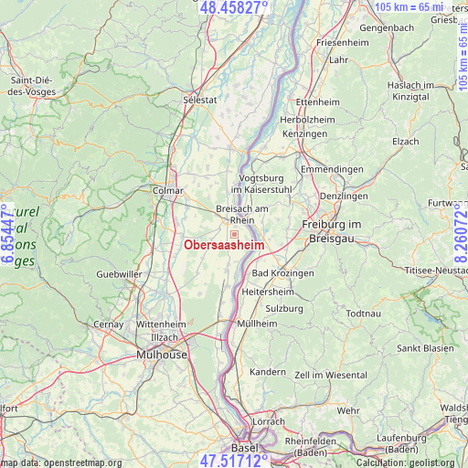
Obersaasheim GPS coordinates[2]
47° 59' 23.424" North, 7° 33' 27.36" East
| Map corner | latitude | longitude |
|---|---|---|
| Upper-left | 48.45827°, | 6.85447° |
| Center: | 47.98984°, | 7.5576° |
| Lower-right: | 47.51712°, | 8.26072° |
| Map W x H: | 104.6×104.6 km | = 65×65mi |
| max Lat: | 51.07786° ⇑41% North |
| Obersaasheim: | 47.98984° |
| min Lat: | ⇓59% South 41.3874° |
| min Long | Obersaasheim | max Long |
| -5.08615° | 7.5576° | 9.52242° |
| W 98.4%⇐ | ⇒1.6% E |
Elevation
Elevation of Obersaasheim is 195 m = 640 ft, and this is 1.3 m = 4 ft above average elevation for this country.
| Max E: |
2333 m = 7654 ft | 34.8% |
| Obersaasheim | 195 m 640 ft | |
| Avg. | 193.7 m = 635 ft | |
Min E: |
-1 m = -3 ft | 65.2% |
See also: France elevation on elevation.city.
Geographical zone
Obersaasheim is located in North temperate zone (between Tropic of Cancer and the Arctic Circle). Distance of this North polar circle is 2065.2 km =1283.3 mi to North.| Distance of | km | miles | from Obersaasheim |
|---|---|---|---|
| North Pole | 4671.1 | 2902.5 | to North |
| Arctic Circle | 2065.2 | 1283.3 | to North |
| Tropic Cancer | 2730.1 | 1696.4 | to South |
| Equator | 5336 | 3315.6 | to South |


Nearby cities:
15 places around Obersaasheim: (largest is in red/bold)
• Algolsheim
1.8 km =1.1 mi,  4°
4°
• Balgau
7 km =4.3 mi,  191°
191°
• Baltzenheim
11.5 km =7.1 mi,  359°
359°
• Biesheim
5.8 km =3.6 mi,  350°
350°
• Blodelsheim
11.7 km =7.3 mi, 187°
• Dessenheim
5.3 km =3.3 mi,  255°
255°
• Fessenheim
8.4 km =5.2 mi, 191°
• Heiteren
2.5 km =1.6 mi,  210°
210°
• Kunheim
9.8 km =6.1 mi, 350°
• Neuf-Brisach
3.8 km =2.4 mi,  324°
324°
• Rustenhart
9 km =5.6 mi,  233°
233°
• Vogelgrun
2.8 km =1.7 mi,  18°
18°
• Volgelsheim
2.8 km =1.7 mi, 355°
• Widensolen
10 km =6.2 mi, 324°
• Wolfgantzen
6 km =3.7 mi,  314°
314°
Sources, notices
• [Note1] Compared only with cities in France existing in our database
• [Src1] Map data: © OpenStreetMap contributors (CC-BY-SA)
• [Src2] Other city data from geonames.org with taken over terms of usage.
• [Src3] Geographical zone / Annual Mean Temperature by Robert A. Rohde @ Wikipedia
