Kunheim geodata
Kunheim (Grand Est) is a populated place; located in France in Europe/Paris (GMT+2) time zone. With population of 1,719 people, there are 5472 cities with bigger population in this country. Compared to other cities in France, 60.7% of cities are located further ↓South; 98.2% of cities are located further ←West and 63.3% of cities have lower elevation than Kunheim. Note1
Administrative division(s):
- Level 1: Grand Est
- Level 2: Haut-Rhin
- Level 3: Arrondissement de Colmar-Ribeauvillé
- Level 4: Kunheim


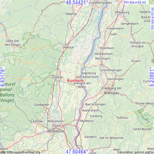
Kunheim GPS coordinates[2]
48° 4' 35.652" North, 7° 32' 5.604" East
| Map corner | latitude | longitude |
|---|---|---|
| Upper-left | 48.54421°, | 6.83176° |
| Center: | 48.07657°, | 7.53489° |
| Lower-right: | 47.60464°, | 8.23801° |
| Map W x H: | 104.5×104.5 km | = 64.9×64.9mi |
| max Lat: | 51.07786° ⇑39.3% North |
| Kunheim: | 48.07657° |
| min Lat: | ⇓60.7% South 41.3874° |
| min Long | Kunheim | max Long |
| -5.08615° | 7.53489° | 9.52242° |
| W 98.2%⇐ | ⇒1.8% E |
Elevation
Elevation of Kunheim is 186 m = 610 ft, and this is 7.7 m = 25 ft below average elevation for this country.
| Max E: |
2333 m = 7654 ft | 36.7% |
| Avg. | 193.7 m = 635 ft | |
| Kunheim | 186 m = 610 ft | |
Min E: |
-1 m = -3 ft | 63.3% |
See also: France elevation on elevation.city.
Geographical zone
Kunheim is located in North temperate zone (between Tropic of Cancer and the Arctic Circle). Distance of this North polar circle is 2055.6 km =1277.3 mi to North.| Distance of | km | miles | from Kunheim |
|---|---|---|---|
| North Pole | 4661.4 | 2896.5 | to North |
| Arctic Circle | 2055.6 | 1277.3 | to North |
| Tropic Cancer | 2739.7 | 1702.4 | to South |
| Equator | 5345.6 | 3321.6 | to South |


Nearby cities:
15 places around Kunheim: (largest is in red/bold)
• Algolsheim
8 km =5 mi,  166°
166°
• Artzenheim
4.4 km =2.7 mi,  6°
6°
• Baltzenheim
2.4 km =1.5 mi,  38°
38°
• Biesheim
4 km =2.5 mi, 169°
• Bischwihr
7.6 km =4.7 mi,  287°
287°
• Durrenentzen
3.1 km =1.9 mi,  306°
306°
• Fortschwihr
6.4 km =4 mi,  281°
281°
• Jebsheim
6.8 km =4.2 mi,  320°
320°
• Muntzenheim
5.2 km =3.2 mi,  302°
302°
• Neuf-Brisach
6.6 km =4.1 mi,  184°
184°
• Urschenheim
3.9 km =2.4 mi, 286°
• Vogelgrun
7.5 km =4.7 mi,  159°
159°
• Volgelsheim
7 km =4.3 mi, 168°
• Widensolen
4.3 km =2.7 mi,  250°
250°
• Wolfgantzen
6 km =3.7 mi,  205°
205°
Sources, notices
• [Note1] Compared only with cities in France existing in our database
• [Src1] Map data: © OpenStreetMap contributors (CC-BY-SA)
• [Src2] Other city data from geonames.org with taken over terms of usage.
• [Src3] Geographical zone / Annual Mean Temperature by Robert A. Rohde @ Wikipedia
