Neuf-Brisach geodata
Neuf-Brisach (Grand Est) is a populated place; located in France in Europe/Paris (GMT+2) time zone. With population of 2,249 people, there are 4283 cities with bigger population in this country. Compared to other cities in France, 59.6% of cities are located further ↓South; 98.2% of cities are located further ←West and 64.6% of cities have lower elevation than Neuf-Brisach. Note1
Administrative division(s):
- Level 1: Grand Est
- Level 2: Haut-Rhin
- Level 3: Arrondissement de Colmar-Ribeauvillé
- Level 4: Neuf-Brisach


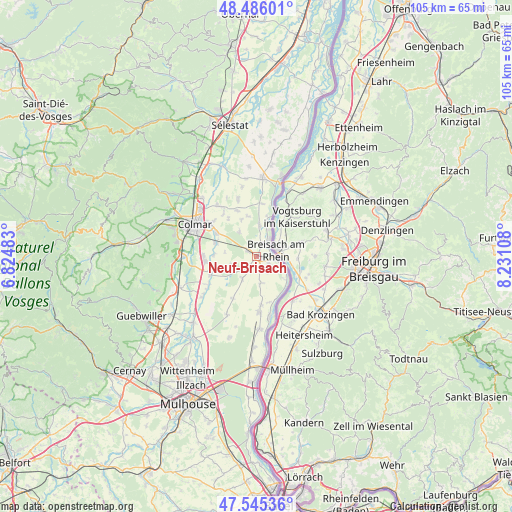
Neuf-Brisach GPS coordinates[2]
48° 1' 4.188" North, 7° 31' 40.62" East
| Map corner | latitude | longitude |
|---|---|---|
| Upper-left | 48.48601°, | 6.82483° |
| Center: | 48.01783°, | 7.52795° |
| Lower-right: | 47.54536°, | 8.23108° |
| Map W x H: | 104.6×104.6 km | = 65×65mi |
| max Lat: | 51.07786° ⇑40.4% North |
| Neuf-Brisach: | 48.01783° |
| min Lat: | ⇓59.6% South 41.3874° |
| min Long | Neuf-Brisach | max Long |
| -5.08615° | 7.52795° | 9.52242° |
| W 98.2%⇐ | ⇒1.8% E |
Elevation
Elevation of Neuf-Brisach is 192 m = 630 ft, and this is 1.7 m = 6 ft below average elevation for this country.
| Max E: |
2333 m = 7654 ft | 35.4% |
| Avg. | 193.7 m = 635 ft | |
| Neuf-Brisach | 192 m = 630 ft | |
Min E: |
-1 m = -3 ft | 64.6% |
See also: France elevation on elevation.city.
Geographical zone
Neuf-Brisach is located in North temperate zone (between Tropic of Cancer and the Arctic Circle). Distance of this North polar circle is 2062.1 km =1281.3 mi to North.| Distance of | km | miles | from Neuf-Brisach |
|---|---|---|---|
| North Pole | 4668 | 2900.6 | to North |
| Arctic Circle | 2062.1 | 1281.3 | to North |
| Tropic Cancer | 2733.2 | 1698.3 | to South |
| Equator | 5339.1 | 3317.6 | to South |


Nearby cities:
15 places around Neuf-Brisach: (largest is in red/bold)
• Algolsheim
2.7 km =1.7 mi,  118°
118°
• Baltzenheim
8.7 km =5.4 mi,  13°
13°
• Biesheim
2.9 km =1.8 mi,  25°
25°
• Dessenheim
5.3 km =3.3 mi,  213°
213°
• Durrenentzen
8.6 km =5.3 mi,  346°
346°
• Heiteren
5.4 km =3.4 mi,  170°
170°
• Kunheim
6.6 km =4.1 mi,  4°
4°
• Logelheim
9 km =5.6 mi,  271°
271°
• Obersaasheim
3.8 km =2.4 mi,  144°
144°
• Sundhoffen
9 km =5.6 mi,  287°
287°
• Urschenheim
8.3 km =5.2 mi,  336°
336°
• Vogelgrun
3.1 km =1.9 mi,  98°
98°
• Volgelsheim
2 km =1.2 mi, 100°
• Widensolen
6.2 km =3.9 mi,  325°
325°
• Wolfgantzen
2.3 km =1.4 mi,  299°
299°
Sources, notices
• [Note1] Compared only with cities in France existing in our database
• [Src1] Map data: © OpenStreetMap contributors (CC-BY-SA)
• [Src2] Other city data from geonames.org with taken over terms of usage.
• [Src3] Geographical zone / Annual Mean Temperature by Robert A. Rohde @ Wikipedia
