Nucourt geodata
Nucourt (Île-de-France) is a populated place; located in France in Europe/Paris (GMT+2) time zone. With population of 827 people, there are 10320 cities with bigger population in this country. Compared to other cities in France, 83.5% of cities are located further ↓South; 58.8% of cities are located further →East and 55.6% of cities have higher elevation than Nucourt. Note1
Administrative division(s):
- Level 1: Île-de-France
- Level 2: Département du Val-d’Oise
- Level 3: Arrondissement de Pontoise
- Level 4: Nucourt


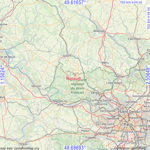
Nucourt GPS coordinates[2]
49° 9' 31.968" North, 1° 51' 12.096" East
| Map corner | latitude | longitude |
|---|---|---|
| Upper-left | 49.61657°, | 1.15024° |
| Center: | 49.15888°, | 1.85336° |
| Lower-right: | 48.69693°, | 2.55649° |
| Map W x H: | 102.3×102.3 km | = 63.6×63.6mi |
| max Lat: | 51.07786° ⇑16.5% North |
| Nucourt: | 49.15888° |
| min Lat: | ⇓83.5% South 41.3874° |
| min Long | Nucourt | max Long |
| -5.08615° | 1.85336° | 9.52242° |
| W 41.2%⇐ | ⇒58.8% E |
Elevation
Elevation of Nucourt is 115 m = 377 ft, and this is 78.7 m = 258 ft below average elevation for this country.
| Max E: |
2333 m = 7654 ft | 55.6% |
| Avg. | 193.7 m = 635 ft | |
| Nucourt | 115 m = 377 ft | |
Min E: |
-1 m = -3 ft | 44.4% |
See also: France elevation on elevation.city.
Geographical zone
Nucourt is located in North temperate zone (between Tropic of Cancer and the Arctic Circle). Distance of this North polar circle is 1935.2 km =1202.5 mi to North.| Distance of | km | miles | from Nucourt |
|---|---|---|---|
| North Pole | 4541.1 | 2821.7 | to North |
| Arctic Circle | 1935.2 | 1202.5 | to North |
| Tropic Cancer | 2860 | 1777.1 | to South |
| Equator | 5466 | 3396.4 | to South |


Nearby cities:
15 places around Nucourt: (largest is in red/bold)
• Avernes
8.3 km =5.2 mi,  170°
170°
• Chars
6.1 km =3.8 mi,  88°
88°
• Delincourt
10.2 km =6.3 mi,  351°
351°
• Genainville
8 km =5 mi,  249°
249°
• Lavilletertre
6.9 km =4.3 mi,  53°
53°
• Le Perchay
7.9 km =4.9 mi,  132°
132°
• Liancourt-Saint-Pierre
9.5 km =5.9 mi,  25°
25°
• Magny-en-Vexin
4.9 km =3 mi,  265°
265°
• Marines
9.5 km =5.9 mi,  99°
99°
• Monneville
10.4 km =6.5 mi,  58°
58°
• Montagny-en-Vexin
5.6 km =3.5 mi,  316°
316°
• Saint-Gervais
6.2 km =3.9 mi,  282°
282°
• Santeuil
8 km =5 mi,  117°
117°
• Us
10.5 km =6.5 mi, 128°
• Vigny
10.4 km =6.5 mi,  148°
148°
Sources, notices
• [Note1] Compared only with cities in France existing in our database
• [Src1] Map data: © OpenStreetMap contributors (CC-BY-SA)
• [Src2] Other city data from geonames.org with taken over terms of usage.
• [Src3] Geographical zone / Annual Mean Temperature by Robert A. Rohde @ Wikipedia
