Lavilletertre geodata
Lavilletertre (Hauts-de-France) is a populated place; located in France in Europe/Paris (GMT+2) time zone. With population of 623 people, there are 12932 cities with bigger population in this country. Compared to other cities in France, 84.2% of cities are located further ↓South; 57.9% of cities are located further →East and 52.3% of cities have higher elevation than Lavilletertre. Note1
Administrative division(s):
- Level 1: Hauts-de-France
- Level 2: Département de l'Oise
- Level 3: Arrondissement de Beauvais
- Level 4: Lavilletertre


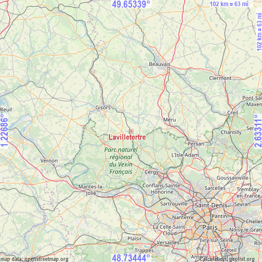
Lavilletertre GPS coordinates[2]
49° 11' 45.78" North, 1° 55' 47.928" East
| Map corner | latitude | longitude |
|---|---|---|
| Upper-left | 49.65339°, | 1.22686° |
| Center: | 49.19605°, | 1.92998° |
| Lower-right: | 48.73444°, | 2.63311° |
| Map W x H: | 102.2×102.2 km | = 63.5×63.5mi |
| max Lat: | 51.07786° ⇑15.8% North |
| Lavilletertre: | 49.19605° |
| min Lat: | ⇓84.2% South 41.3874° |
| min Long | Lavilletertre | max Long |
| -5.08615° | 1.92998° | 9.52242° |
| W 42.1%⇐ | ⇒57.9% E |
Elevation
Elevation of Lavilletertre is 124 m = 407 ft, and this is 69.7 m = 229 ft below average elevation for this country.
| Max E: |
2333 m = 7654 ft | 52.3% |
| Avg. | 193.7 m = 635 ft | |
| Lavilletertre | 124 m = 407 ft | |
Min E: |
-1 m = -3 ft | 47.7% |
See also: France elevation on elevation.city.
Geographical zone
Lavilletertre is located in North temperate zone (between Tropic of Cancer and the Arctic Circle). Distance of this North polar circle is 1931.1 km =1199.9 mi to North.| Distance of | km | miles | from Lavilletertre |
|---|---|---|---|
| North Pole | 4537 | 2819.2 | to North |
| Arctic Circle | 1931.1 | 1199.9 | to North |
| Tropic Cancer | 2864.2 | 1779.7 | to South |
| Equator | 5470.1 | 3399 | to South |


Nearby cities:
15 places around Lavilletertre: (largest is in red/bold)
• Chars
4 km =2.5 mi,  173°
173°
• Chaumont-en-Vexin
8.4 km =5.2 mi,  337°
337°
• Cormeilles-en-Vexin
11 km =6.8 mi,  143°
143°
• Delincourt
9.2 km =5.7 mi,  310°
310°
• Fresneaux-Montchevreuil
10.9 km =6.8 mi,  29°
29°
• Hénonville
9 km =5.6 mi,  82°
82°
• Ivry-le-Temple
8.2 km =5.1 mi,  63°
63°
• Le Perchay
9.5 km =5.9 mi,  178°
178°
• Liancourt-Saint-Pierre
4.6 km =2.9 mi, 341°
• Marines
6.8 km =4.2 mi,  146°
146°
• Monneville
3.5 km =2.2 mi,  69°
69°
• Montagny-en-Vexin
9.4 km =5.8 mi,  269°
269°
• Nucourt
6.9 km =4.3 mi,  233°
233°
• Santeuil
8 km =5 mi, 168°
• Us
11 km =6.8 mi, 165°
Sources, notices
• [Note1] Compared only with cities in France existing in our database
• [Src1] Map data: © OpenStreetMap contributors (CC-BY-SA)
• [Src2] Other city data from geonames.org with taken over terms of usage.
• [Src3] Geographical zone / Annual Mean Temperature by Robert A. Rohde @ Wikipedia
