Montagny-en-Vexin geodata
Montagny-en-Vexin (Hauts-de-France) is a populated place; located in France in Europe/Paris (GMT+2) time zone. With population of 580 people, there are 13652 cities with bigger population in this country. Compared to other cities in France, 84.2% of cities are located further ↓South; 59.4% of cities are located further →East and 51.7% of cities have higher elevation than Montagny-en-Vexin. Note1
Administrative division(s):
- Level 1: Hauts-de-France
- Level 2: Département de l'Oise
- Level 3: Arrondissement de Beauvais
- Level 4: Montagny-en-Vexin


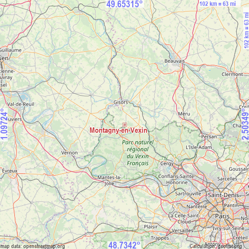
Montagny-en-Vexin GPS coordinates[2]
49° 11' 44.916" North, 1° 48' 1.296" East
| Map corner | latitude | longitude |
|---|---|---|
| Upper-left | 49.65315°, | 1.09724° |
| Center: | 49.19581°, | 1.80036° |
| Lower-right: | 48.7342°, | 2.50349° |
| Map W x H: | 102.2×102.2 km | = 63.5×63.5mi |
| max Lat: | 51.07786° ⇑15.8% North |
| Montagny-en-Vexin: | 49.19581° |
| min Lat: | ⇓84.2% South 41.3874° |
| min Long | Montagny-en-Vex | max Long |
| -5.08615° | 1.80036° | 9.52242° |
| W 40.6%⇐ | ⇒59.4% E |
Elevation
Elevation of Montagny-en-Vexin is 126 m = 413 ft, and this is 67.7 m = 222 ft below average elevation for this country.
| Max E: |
2333 m = 7654 ft | 51.7% |
| Avg. | 193.7 m = 635 ft | |
| Montagny-en-Vexin | 126 m = 413 ft | |
Min E: |
-1 m = -3 ft | 48.3% |
See also: France elevation on elevation.city.
Geographical zone
Montagny-en-Vexin is located in North temperate zone (between Tropic of Cancer and the Arctic Circle). Distance of this North polar circle is 1931.1 km =1199.9 mi to North.| Distance of | km | miles | from Montagny-en-Vexin |
|---|---|---|---|
| North Pole | 4537 | 2819.2 | to North |
| Arctic Circle | 1931.1 | 1199.9 | to North |
| Tropic Cancer | 2864.1 | 1779.7 | to South |
| Equator | 5470.1 | 3399 | to South |


Nearby cities:
15 places around Montagny-en-Vexin: (largest is in red/bold)
• Chaumont-en-Vexin
10 km =6.2 mi,  38°
38°
• Château-sur-Epte
10.1 km =6.3 mi,  271°
271°
• Courcelles-lès-Gisors
8.3 km =5.2 mi,  329°
329°
• Dangu
9.9 km =6.2 mi,  309°
309°
• Delincourt
6.5 km =4 mi,  21°
21°
• Genainville
7.9 km =4.9 mi,  207°
207°
• Gisors
9.7 km =6 mi,  351°
351°
• Lavilletertre
9.4 km =5.8 mi,  89°
89°
• Liancourt-Saint-Pierre
9.1 km =5.7 mi,  60°
60°
• Magny-en-Vexin
4.6 km =2.9 mi,  192°
192°
• Neaufles-Saint-Martin
10.4 km =6.5 mi, 329°
• Nucourt
5.6 km =3.5 mi,  136°
136°
• Saint-Clair-sur-Epte
8.8 km =5.5 mi,  278°
278°
• Saint-Gervais
3.5 km =2.2 mi,  217°
217°
• Trie-Château
10.1 km =6.3 mi,  8°
8°
Sources, notices
• [Note1] Compared only with cities in France existing in our database
• [Src1] Map data: © OpenStreetMap contributors (CC-BY-SA)
• [Src2] Other city data from geonames.org with taken over terms of usage.
• [Src3] Geographical zone / Annual Mean Temperature by Robert A. Rohde @ Wikipedia
