Montreuil-aux-Lions geodata
Montreuil-aux-Lions (Hauts-de-France) is a populated place; located in France in Europe/Paris (GMT+2) time zone. With population of 1,201 people, there are 7527 cities with bigger population in this country. Compared to other cities in France, 80.2% of cities are located further ↓South; 60.5% of cities are located further ←West and 52.5% of cities have lower elevation than Montreuil-aux-Lions. Note1
Administrative division(s):
- Level 1: Hauts-de-France
- Level 2: Département de l'Aisne
- Level 3: Arrondissement de Château-Thierry
- Level 4: Montreuil-aux-Lions


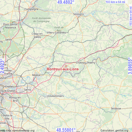
Montreuil-aux-Lions GPS coordinates[2]
49° 1' 16.464" North, 3° 11' 43.548" East
| Map corner | latitude | longitude |
|---|---|---|
| Upper-left | 49.4802°, | 2.4923° |
| Center: | 49.02124°, | 3.19543° |
| Lower-right: | 48.55801°, | 3.89855° |
| Map W x H: | 102.5×102.5 km | = 63.7×63.7mi |
| max Lat: | 51.07786° ⇑19.8% North |
| Montreuil-aux-Lions: | 49.02124° |
| min Lat: | ⇓80.2% South 41.3874° |
| min Long | Montreuil-aux-L | max Long |
| -5.08615° | 3.19543° | 9.52242° |
| W 60.5%⇐ | ⇒39.5% E |
Elevation
Elevation of Montreuil-aux-Lions is 141 m = 463 ft, and this is 52.7 m = 173 ft below average elevation for this country.
| Max E: |
2333 m = 7654 ft | 47.5% |
| Avg. | 193.7 m = 635 ft | |
| Montreuil-aux-Lions | 141 m = 463 ft | |
Min E: |
-1 m = -3 ft | 52.5% |
See also: France elevation on elevation.city.
Geographical zone
Montreuil-aux-Lions is located in North temperate zone (between Tropic of Cancer and the Arctic Circle). Distance of this North polar circle is 1950.5 km =1212 mi to North.| Distance of | km | miles | from Montreuil-aux-Lions |
|---|---|---|---|
| North Pole | 4556.4 | 2831.2 | to North |
| Arctic Circle | 1950.5 | 1212 | to North |
| Tropic Cancer | 2844.7 | 1767.6 | to South |
| Equator | 5450.7 | 3386.9 | to South |


Nearby cities:
15 places around Montreuil-aux-Lions: (largest is in red/bold)
• Chamigny
6.3 km =3.9 mi,  210°
210°
• Charly-sur-Marne
8.1 km =5 mi,  126°
126°
• Citry
6.7 km =4.2 mi,  151°
151°
• Cocherel
6.7 km =4.2 mi,  270°
270°
• Coulombs-en-Valois
6.8 km =4.2 mi,  318°
318°
• Domptin
6 km =3.7 mi,  95°
95°
• Gandelu
8.1 km =5 mi,  354°
354°
• La Ferté-sous-Jouarre
9.2 km =5.7 mi, 212°
• Luzancy
5.5 km =3.4 mi,  190°
190°
• Méry-sur-Marne
6.3 km =3.9 mi,  176°
176°
• Nanteuil-sur-Marne
5.1 km =3.2 mi,  159°
159°
• Reuil-en-Brie
7.6 km =4.7 mi, 207°
• Sainte-Aulde
3.5 km =2.2 mi, 208°
• Saâcy-sur-Marne
6.7 km =4.2 mi,  170°
170°
• Vendrest
7.9 km =4.9 mi,  290°
290°
Sources, notices
• [Note1] Compared only with cities in France existing in our database
• [Src1] Map data: © OpenStreetMap contributors (CC-BY-SA)
• [Src2] Other city data from geonames.org with taken over terms of usage.
• [Src3] Geographical zone / Annual Mean Temperature by Robert A. Rohde @ Wikipedia
