Chamigny geodata
Chamigny (Île-de-France) is a populated place; located in France in Europe/Paris (GMT+2) time zone. With population of 1,326 people, there are 6910 cities with bigger population in this country. Compared to other cities in France, 79% of cities are located further ↓South; 59.9% of cities are located further ←West and 73.1% of cities have higher elevation than Chamigny. Note1
Administrative division(s):
- Level 1: Île-de-France
- Level 2: Seine-et-Marne
- Level 3: Arrondissement de Meaux
- Level 4: Chamigny


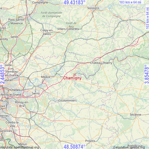
Chamigny GPS coordinates[2]
48° 58' 20.712" North, 3° 9' 5.94" East
| Map corner | latitude | longitude |
|---|---|---|
| Upper-left | 49.43183°, | 2.44853° |
| Center: | 48.97242°, | 3.15165° |
| Lower-right: | 48.50874°, | 3.85478° |
| Map W x H: | 102.6×102.6 km | = 63.8×63.8mi |
| max Lat: | 51.07786° ⇑21% North |
| Chamigny: | 48.97242° |
| min Lat: | ⇓79% South 41.3874° |
| min Long | Chamigny | max Long |
| -5.08615° | 3.15165° | 9.52242° |
| W 59.9%⇐ | ⇒40.1% E |
Elevation
Elevation of Chamigny is 71 m = 233 ft, and this is 122.7 m = 403 ft below average elevation for this country.
| Max E: |
2333 m = 7654 ft | 73.1% |
| Avg. | 193.7 m = 635 ft | |
| Chamigny | 71 m = 233 ft | |
Min E: |
-1 m = -3 ft | 26.9% |
See also: France elevation on elevation.city.
Geographical zone
Chamigny is located in North temperate zone (between Tropic of Cancer and the Arctic Circle). Distance of this North polar circle is 1956 km =1215.4 mi to North.| Distance of | km | miles | from Chamigny |
|---|---|---|---|
| North Pole | 4561.8 | 2834.6 | to North |
| Arctic Circle | 1956 | 1215.4 | to North |
| Tropic Cancer | 2839.3 | 1764.3 | to South |
| Equator | 5445.2 | 3383.5 | to South |


Nearby cities:
15 places around Chamigny: (largest is in red/bold)
• Citry
6.4 km =4 mi,  94°
94°
• Cocherel
6.5 km =4 mi,  326°
326°
• Jouarre
5.3 km =3.3 mi,  195°
195°
• La Ferté-sous-Jouarre
2.9 km =1.8 mi,  217°
217°
• Luzancy
2.2 km =1.4 mi, 89°
• Montreuil-aux-Lions
6.3 km =3.9 mi,  30°
30°
• Méry-sur-Marne
3.6 km =2.2 mi,  103°
103°
• Nanteuil-sur-Marne
5 km =3.1 mi,  82°
82°
• Reuil-en-Brie
1.4 km =0.9 mi,  193°
193°
• Saint-Cyr-sur-Morin
7.6 km =4.7 mi,  164°
164°
• Sainte-Aulde
2.8 km =1.7 mi, 32°
• Sammeron
5.7 km =3.5 mi,  240°
240°
• Saâcy-sur-Marne
4.5 km =2.8 mi, 104°
• Signy-Signets
8 km =5 mi,  231°
231°
• Ussy-sur-Marne
6 km =3.7 mi,  253°
253°
Sources, notices
• [Note1] Compared only with cities in France existing in our database
• [Src1] Map data: © OpenStreetMap contributors (CC-BY-SA)
• [Src2] Other city data from geonames.org with taken over terms of usage.
• [Src3] Geographical zone / Annual Mean Temperature by Robert A. Rohde @ Wikipedia
