Montfarville geodata
Montfarville (Normandy) is a populated place; located in France in Europe/Paris (GMT+2) time zone. With population of 876 people, there are 9846 cities with bigger population in this country. Compared to other cities in France, 91.2% of cities are located further ↓South; 90.6% of cities are located further →East and 96.7% of cities have higher elevation than Montfarville. Note1
Administrative division(s):
- Level 1: Normandy
- Level 2: Manche
- Level 3: Arrondissement de Cherbourg
- Level 4: Montfarville


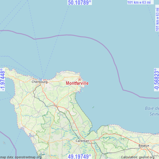
Montfarville GPS coordinates[2]
49° 39' 17.352" North, 1° 16' 16.896" West
| Map corner | latitude | longitude |
|---|---|---|
| Upper-left | 50.10789°, | -1.97448° |
| Center: | 49.65482°, | -1.27136° |
| Lower-right: | 49.19749°, | -0.56823° |
| Map W x H: | 101.2×101.2 km | = 62.9×62.9mi |
| max Lat: | 51.07786° ⇑8.8% North |
| Montfarville: | 49.65482° |
| min Lat: | ⇓91.2% South 41.3874° |
| min Long | Montfarville | max Long |
| -5.08615° | -1.27136° | 9.52242° |
| W 9.4%⇐ | ⇒90.6% E |
Elevation
Elevation of Montfarville is 12 m = 39 ft, and this is 181.7 m = 596 ft below average elevation for this country.
| Max E: |
2333 m = 7654 ft | 96.7% |
| Avg. | 193.7 m = 635 ft | |
| Montfarville | 12 m = 39 ft | |
Min E: |
-1 m = -3 ft | 3.3% |
See also: France elevation on elevation.city.
Geographical zone
Montfarville is located in North temperate zone (between Tropic of Cancer and the Arctic Circle). Distance of this North polar circle is 1880.1 km =1168.2 mi to North.| Distance of | km | miles | from Montfarville |
|---|---|---|---|
| North Pole | 4486 | 2787.5 | to North |
| Arctic Circle | 1880.1 | 1168.2 | to North |
| Tropic Cancer | 2915.2 | 1811.4 | to South |
| Equator | 5521.1 | 3430.7 | to South |


Nearby cities:
15 places around Montfarville: (largest is in red/bold)
• Barfleur
1.7 km =1.1 mi,  15°
15°
• Bretteville
18.5 km =11.5 mi,  269°
269°
• Cosqueville
10.8 km =6.7 mi,  293°
293°
• Digosville
18.5 km =11.5 mi,  261°
261°
• Fermanville
14.2 km =8.8 mi,  284°
284°
• Gatteville-le-Phare
3.7 km =2.3 mi,  344°
344°
• Gonneville
14 km =8.7 mi, 263°
• Le Theil
15.2 km =9.4 mi,  250°
250°
• Quettehou
7.2 km =4.5 mi,  198°
198°
• Réville
4.1 km =2.5 mi,  167°
167°
• Saint-Pierre-Église
9.6 km =6 mi, 279°
• Saint-Vaast-la-Hougue
7.4 km =4.6 mi,  178°
178°
• Saussemesnil
16.5 km =10.3 mi,  236°
236°
• Tamerville
18.9 km =11.7 mi,  223°
223°
• Teurthéville-Bocage
11.4 km =7.1 mi,  232°
232°
Sources, notices
• [Note1] Compared only with cities in France existing in our database
• [Src1] Map data: © OpenStreetMap contributors (CC-BY-SA)
• [Src2] Other city data from geonames.org with taken over terms of usage.
• [Src3] Geographical zone / Annual Mean Temperature by Robert A. Rohde @ Wikipedia
