Montesquieu-Volvestre geodata
Montesquieu-Volvestre (Occitanie) is a populated place; located in France in Europe/Paris (GMT+2) time zone. With population of 2,635 people, there are 3698 cities with bigger population in this country. Compared to other cities in France, 97% of cities are located further ↑North; 66.4% of cities are located further →East and 72.2% of cities have lower elevation than Montesquieu-Volvestre. Note1
Administrative division(s):
- Level 1: Occitanie
- Level 2: Haute-Garonne
- Level 3: Arrondissement de Muret
- Level 4: Montesquieu-Volvestre
Current local time in Montesquieu-Volvestre:
11:34 PM, SaturdayDifference from your time zone: hours


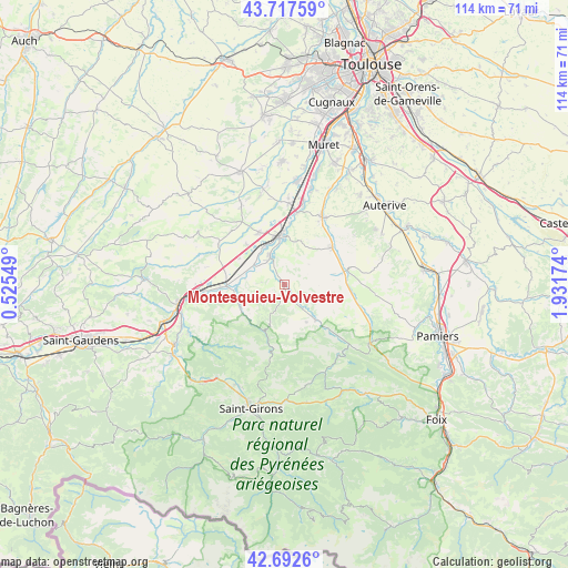
Montesquieu-Volvestre GPS coordinates[2]
43° 12' 26.1" North, 1° 13' 43.032" East
| Map corner | latitude | longitude |
|---|---|---|
| Upper-left | 43.71759°, | 0.52549° |
| Center: | 43.20725°, | 1.22862° |
| Lower-right: | 42.6926°, | 1.93174° |
| Map W x H: | 114×114 km | = 70.8×70.8mi |
| max Lat: | 51.07786° ⇑97% North |
| Montesquieu-Volvestre: | 43.20725° |
| min Lat: | ⇓3% South 41.3874° |
| min Long | Montesquieu-Vol | max Long |
| -5.08615° | 1.22862° | 9.52242° |
| W 33.6%⇐ | ⇒66.4% E |
Elevation
Elevation of Montesquieu-Volvestre is 231 m = 758 ft, and this is 37.3 m = 122 ft above average elevation for this country.
| Max E: |
2333 m = 7654 ft | 27.8% |
| Montesquieu-Volvestre | 231 m 758 ft | |
| Avg. | 193.7 m = 635 ft | |
Min E: |
-1 m = -3 ft | 72.2% |
See also: France elevation on elevation.city.
Geographical zone
Montesquieu-Volvestre is located in North temperate zone (between Tropic of Cancer and the Arctic Circle). Distance of this Northern Tropic circle is 2198.3 km =1366 mi to South.| Distance of | km | miles | from Montesquieu-Volvestre |
|---|---|---|---|
| North Pole | 5202.9 | 3232.9 | to North |
| Arctic Circle | 2597 | 1613.7 | to North |
| Tropic Cancer | 2198.3 | 1366 | to South |
| Equator | 4804.2 | 2985.2 | to South |


Nearby cities:
15 places around Montesquieu-Volvestre: (largest is in red/bold)
• Carbonne
10.2 km =6.3 mi,  358°
358°
• Carla-Bayle
14.8 km =9.2 mi,  115°
115°
• Cazères
11.5 km =7.1 mi,  269°
269°
• Daumazan-sur-Arize
9.5 km =5.9 mi,  138°
138°
• Lafitte-Vigordane
11.5 km =7.1 mi,  334°
334°
• Lavelanet-de-Comminges
10.5 km =6.5 mi,  300°
300°
• Le Fossat
15 km =9.3 mi,  104°
104°
• Lézat-sur-Lèze
12.3 km =7.6 mi,  50°
50°
• Marquefave
12.4 km =7.7 mi,  6°
6°
• Palaminy
13.1 km =8.1 mi, 267°
• Rieux-Volvestre
5.3 km =3.3 mi, 333°
• Saint-Sulpice-sur-Lèze
15.6 km =9.7 mi,  28°
28°
• Saint-Ybars
13.2 km =8.2 mi,  75°
75°
• Saint-Élix-le-Château
11 km =6.8 mi,  317°
317°
• Sainte-Croix-Volvestre
9.6 km =6 mi,  211°
211°
Sources, notices
• [Note1] Compared only with cities in France existing in our database
• [Src1] Map data: © OpenStreetMap contributors (CC-BY-SA)
• [Src2] Other city data from geonames.org with taken over terms of usage.
• [Src3] Geographical zone / Annual Mean Temperature by Robert A. Rohde @ Wikipedia
