Montbazens geodata
Montbazens (Occitanie) is a populated place; located in France in Europe/Paris (GMT+2) time zone. With population of 1,396 people, there are 6623 cities with bigger population in this country. Compared to other cities in France, 83.7% of cities are located further ↑North; 53.9% of cities are located further →East and 91.5% of cities have lower elevation than Montbazens. Note1
Administrative division(s):
- Level 1: Occitanie
- Level 2: Département de l'Aveyron
- Level 3: Arrondissement de Villefranche-de-Rouergue
- Level 4: Montbazens


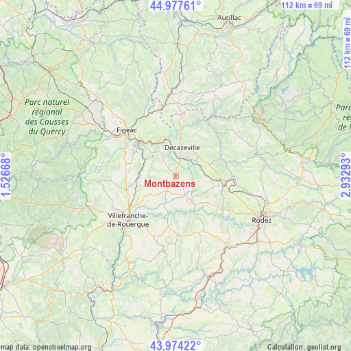
Montbazens GPS coordinates[2]
44° 28' 41.052" North, 2° 13' 47.28" East
| Map corner | latitude | longitude |
|---|---|---|
| Upper-left | 44.97761°, | 1.52668° |
| Center: | 44.47807°, | 2.2298° |
| Lower-right: | 43.97422°, | 2.93293° |
| Map W x H: | 111.6×111.6 km | = 69.3×69.3mi |
| max Lat: | 51.07786° ⇑83.7% North |
| Montbazens: | 44.47807° |
| min Lat: | ⇓16.3% South 41.3874° |
| min Long | Montbazens | max Long |
| -5.08615° | 2.2298° | 9.52242° |
| W 46.1%⇐ | ⇒53.9% E |
Elevation
Elevation of Montbazens is 464 m = 1522 ft, and this is 270.3 m = 887 ft above average elevation for this country.
| Max E: |
2333 m = 7654 ft | 8.5% |
| Montbazens | 464 m 1522 ft | |
| Avg. | 193.7 m = 635 ft | |
Min E: |
-1 m = -3 ft | 91.5% |
See also: France elevation on elevation.city.
Geographical zone
Montbazens is located in North temperate zone (between Tropic of Cancer and the Arctic Circle). Distance of this Northern Tropic circle is 2339.6 km =1453.8 mi to South.| Distance of | km | miles | from Montbazens |
|---|---|---|---|
| North Pole | 5061.6 | 3145.1 | to North |
| Arctic Circle | 2455.7 | 1525.9 | to North |
| Tropic Cancer | 2339.6 | 1453.8 | to South |
| Equator | 4945.5 | 3073 | to South |


Nearby cities:
15 places around Montbazens: (largest is in red/bold)
• Anglars-Saint-Félix
6.2 km =3.9 mi,  188°
188°
• Aubin
5.7 km =3.5 mi,  11°
11°
• Auzits
8.4 km =5.2 mi,  68°
68°
• Boisse-Penchot
12.8 km =8 mi,  351°
351°
• Cransac
6.7 km =4.2 mi,  39°
39°
• Decazeville
9.3 km =5.8 mi, 10°
• Firmi
9.3 km =5.8 mi, 41°
• Flagnac
14.2 km =8.8 mi, 5°
• Lanuéjouls
7.1 km =4.4 mi,  225°
225°
• Livinhac-le-Haut
12.7 km =7.9 mi,  0°
0°
• Maleville
13.5 km =8.4 mi, 228°
• Rignac
9.1 km =5.7 mi,  148°
148°
• Saint-Christophe-Vallon
14.5 km =9 mi,  93°
93°
• Valady
15.9 km =9.9 mi,  98°
98°
• Viviez
8.8 km =5.5 mi, 353°
Sources, notices
• [Note1] Compared only with cities in France existing in our database
• [Src1] Map data: © OpenStreetMap contributors (CC-BY-SA)
• [Src2] Other city data from geonames.org with taken over terms of usage.
• [Src3] Geographical zone / Annual Mean Temperature by Robert A. Rohde @ Wikipedia
