Livinhac-le-Haut geodata
Livinhac-le-Haut (Occitanie) is a populated place; located in France in Europe/Paris (GMT+2) time zone. With population of 1,181 people, there are 7641 cities with bigger population in this country. Compared to other cities in France, 82.8% of cities are located further ↑North; 53.9% of cities are located further →East and 69.6% of cities have lower elevation than Livinhac-le-Haut. Note1
Administrative division(s):
- Level 1: Occitanie
- Level 2: Département de l'Aveyron
- Level 3: Arrondissement de Villefranche-de-Rouergue
- Level 4: Livinhac-le-Haut


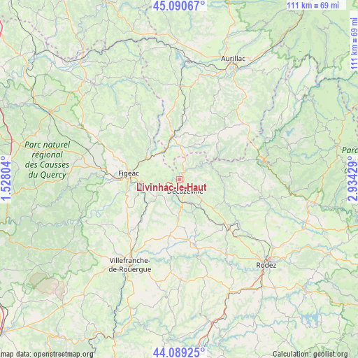
Livinhac-le-Haut GPS coordinates[2]
44° 35' 31.632" North, 2° 13' 52.212" East
| Map corner | latitude | longitude |
|---|---|---|
| Upper-left | 45.09067°, | 1.52804° |
| Center: | 44.59212°, | 2.23117° |
| Lower-right: | 44.08925°, | 2.93429° |
| Map W x H: | 111.3×111.3 km | = 69.2×69.2mi |
| max Lat: | 51.07786° ⇑82.8% North |
| Livinhac-le-Haut: | 44.59212° |
| min Lat: | ⇓17.2% South 41.3874° |
| min Long | Livinhac-le-Hau | max Long |
| -5.08615° | 2.23117° | 9.52242° |
| W 46.1%⇐ | ⇒53.9% E |
Elevation
Elevation of Livinhac-le-Haut is 217 m = 712 ft, and this is 23.3 m = 76 ft above average elevation for this country.
| Max E: |
2333 m = 7654 ft | 30.4% |
| Livinhac-le-Haut | 217 m 712 ft | |
| Avg. | 193.7 m = 635 ft | |
Min E: |
-1 m = -3 ft | 69.6% |
See also: France elevation on elevation.city.
Geographical zone
Livinhac-le-Haut is located in North temperate zone (between Tropic of Cancer and the Arctic Circle). Distance of this Northern Tropic circle is 2352.3 km =1461.7 mi to South.| Distance of | km | miles | from Livinhac-le-Haut |
|---|---|---|---|
| North Pole | 5048.9 | 3137.2 | to North |
| Arctic Circle | 2443 | 1518 | to North |
| Tropic Cancer | 2352.3 | 1461.7 | to South |
| Equator | 4958.2 | 3080.9 | to South |


Nearby cities:
15 places around Livinhac-le-Haut: (largest is in red/bold)
• Aubin
7.2 km =4.5 mi,  171°
171°
• Auzits
12.3 km =7.6 mi,  141°
141°
• Bagnac-sur-Célé
9.7 km =6 mi,  328°
328°
• Boisse-Penchot
1.9 km =1.2 mi,  270°
270°
• Capdenac-Gare
12 km =7.5 mi,  261°
261°
• Cransac
8.6 km =5.3 mi,  151°
151°
• Decazeville
3.9 km =2.4 mi,  156°
156°
• Firmi
8.3 km =5.2 mi,  133°
133°
• Flagnac
2 km =1.2 mi,  42°
42°
• Maurs
13.4 km =8.3 mi,  348°
348°
• Montbazens
12.7 km =7.9 mi,  180°
180°
• Saint-Constant
10.3 km =6.4 mi,  0°
0°
• Saint-Santin
6.5 km =4 mi, 349°
• Saint-Étienne-de-Maurs
14 km =8.7 mi, 352°
• Viviez
4.1 km =2.5 mi,  196°
196°
Sources, notices
• [Note1] Compared only with cities in France existing in our database
• [Src1] Map data: © OpenStreetMap contributors (CC-BY-SA)
• [Src2] Other city data from geonames.org with taken over terms of usage.
• [Src3] Geographical zone / Annual Mean Temperature by Robert A. Rohde @ Wikipedia
