Mongauzy geodata
Mongauzy (Nouvelle-Aquitaine) is a populated place; located in France in Europe/Paris (GMT+2) time zone. With population of 626 people, there are 12883 cities with bigger population in this country. Compared to other cities in France, 83% of cities are located further ↑North; 77.9% of cities are located further →East and 92.7% of cities have higher elevation than Mongauzy. Note1
Administrative division(s):
- Level 1: Nouvelle-Aquitaine
- Level 2: Gironde
- Level 3: Arrondissement de Langon
- Level 4: Mongauzy


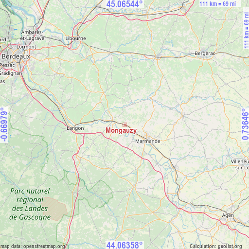
Mongauzy GPS coordinates[2]
44° 34' 0.012" North, 0° 1' 59.988" East
| Map corner | latitude | longitude |
|---|---|---|
| Upper-left | 45.06544°, | -0.66979° |
| Center: | 44.56667°, | 0.03333° |
| Lower-right: | 44.06358°, | 0.73646° |
| Map W x H: | 111.4×111.4 km | = 69.2×69.2mi |
| max Lat: | 51.07786° ⇑83% North |
| Mongauzy: | 44.56667° |
| min Lat: | ⇓17% South 41.3874° |
| min Long | Mongauzy | max Long |
| -5.08615° | 0.03333° | 9.52242° |
| W 22.1%⇐ | ⇒77.9% E |
Elevation
Elevation of Mongauzy is 23 m = 75 ft, and this is 170.7 m = 560 ft below average elevation for this country.
| Max E: |
2333 m = 7654 ft | 92.7% |
| Avg. | 193.7 m = 635 ft | |
| Mongauzy | 23 m = 75 ft | |
Min E: |
-1 m = -3 ft | 7.3% |
See also: France elevation on elevation.city.
Geographical zone
Mongauzy is located in North temperate zone (between Tropic of Cancer and the Arctic Circle). Distance of this Northern Tropic circle is 2349.4 km =1459.8 mi to South.| Distance of | km | miles | from Mongauzy |
|---|---|---|---|
| North Pole | 5051.7 | 3139 | to North |
| Arctic Circle | 2445.8 | 1519.7 | to North |
| Tropic Cancer | 2349.4 | 1459.8 | to South |
| Equator | 4955.3 | 3079.1 | to South |


Nearby cities:
15 places around Mongauzy: (largest is in red/bold)
• Beaupuy
9.8 km =6.1 mi,  110°
110°
• Castelnau-sur-Gupie
8 km =5 mi,  96°
96°
• Cocumont
13.2 km =8.2 mi,  182°
182°
• Fontet
5.1 km =3.2 mi,  260°
260°
• Gironde-sur-Dropt
9.4 km =5.8 mi,  281°
281°
• La Réole
5.8 km =3.6 mi,  287°
287°
• Lagupie
6.5 km =4 mi, 101°
• Marcellus
10.2 km =6.3 mi,  159°
159°
• Marmande
12.8 km =8 mi,  125°
125°
• Meilhan-sur-Garonne
5 km =3.1 mi, 178°
• Monségur
10 km =6.2 mi,  21°
21°
• Montpouillan
12.4 km =7.7 mi,  152°
152°
• Morizès
11 km =6.8 mi,  297°
297°
• Sainte-Bazeille
6.5 km =4 mi, 128°
• Savignac
12.2 km =7.6 mi,  246°
246°
Sources, notices
• [Note1] Compared only with cities in France existing in our database
• [Src1] Map data: © OpenStreetMap contributors (CC-BY-SA)
• [Src2] Other city data from geonames.org with taken over terms of usage.
• [Src3] Geographical zone / Annual Mean Temperature by Robert A. Rohde @ Wikipedia
