Moëlan-sur-Mer geodata
Moëlan-sur-Mer (Brittany) is a populated place; located in France in Europe/Paris (GMT+2) time zone. With population of 6,984 people, there are 1409 cities with bigger population in this country. Compared to other cities in France, 56% of cities are located further ↓South; 98.5% of cities are located further →East and 79.4% of cities have higher elevation than Moëlan-sur-Mer. Note1
Administrative division(s):
- Level 1: Brittany
- Level 2: Département du Finistère
- Level 3: Arrondissement de Quimper
- Level 4: Moëlan-sur-Mer


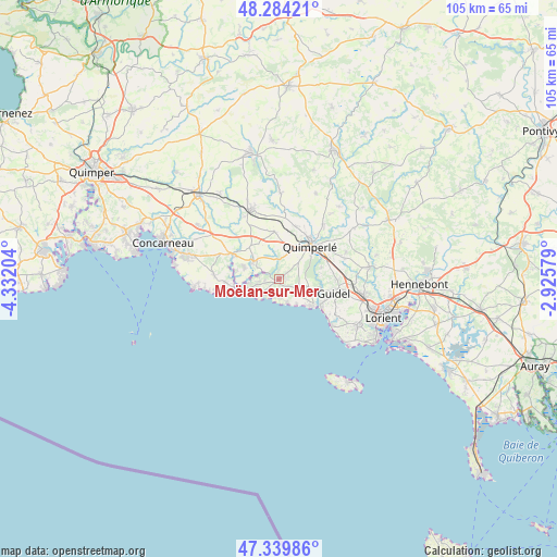
Moëlan-sur-Mer GPS coordinates[2]
47° 48' 51.048" North, 3° 37' 44.112" West
| Map corner | latitude | longitude |
|---|---|---|
| Upper-left | 48.28421°, | -4.33204° |
| Center: | 47.81418°, | -3.62892° |
| Lower-right: | 47.33986°, | -2.92579° |
| Map W x H: | 105×105 km | = 65.2×65.2mi |
| max Lat: | 51.07786° ⇑44% North |
| Moëlan-sur-Mer: | 47.81418° |
| min Lat: | ⇓56% South 41.3874° |
| min Long | Moëlan-sur-Mer | max Long |
| -5.08615° | -3.62892° | 9.52242° |
| W 1.5%⇐ | ⇒98.5% E |
Elevation
Elevation of Moëlan-sur-Mer is 56 m = 184 ft, and this is 137.7 m = 452 ft below average elevation for this country.
| Max E: |
2333 m = 7654 ft | 79.4% |
| Avg. | 193.7 m = 635 ft | |
| Moëlan-sur-Mer | 56 m = 184 ft | |
Min E: |
-1 m = -3 ft | 20.6% |
See also: France elevation on elevation.city.
Geographical zone
Moëlan-sur-Mer is located in North temperate zone (between Tropic of Cancer and the Arctic Circle). Distance of this North polar circle is 2084.7 km =1295.4 mi to North.| Distance of | km | miles | from Moëlan-sur-Mer |
|---|---|---|---|
| North Pole | 4690.6 | 2914.6 | to North |
| Arctic Circle | 2084.7 | 1295.4 | to North |
| Tropic Cancer | 2710.5 | 1684.2 | to South |
| Equator | 5316.4 | 3303.5 | to South |


Nearby cities:
15 places around Moëlan-sur-Mer: (largest is in red/bold)
• Bannalec
14.1 km =8.8 mi,  338°
338°
• Baye
5.1 km =3.2 mi,  20°
20°
• Clohars-Carnoët
3.8 km =2.4 mi,  121°
121°
• Gestel
14 km =8.7 mi,  94°
94°
• Guidel-Plage
9.5 km =5.9 mi, 122°
• Lanmeur
6.9 km =4.3 mi,  288°
288°
• Le Trévoux
9 km =5.6 mi,  354°
354°
• Mellac
10.7 km =6.6 mi, 21°
• Névez
12.2 km =7.6 mi,  272°
272°
• Pont-Aven
9.9 km =6.2 mi, 293°
• Quimperlé
8.3 km =5.2 mi,  45°
45°
• Riec-sur-Belon
5.7 km =3.5 mi, 291°
• Rédené
12.7 km =7.9 mi,  71°
71°
• Saint-Thurien
15.1 km =9.4 mi,  358°
358°
• Tréméven
11.9 km =7.4 mi,  36°
36°
Sources, notices
• [Note1] Compared only with cities in France existing in our database
• [Src1] Map data: © OpenStreetMap contributors (CC-BY-SA)
• [Src2] Other city data from geonames.org with taken over terms of usage.
• [Src3] Geographical zone / Annual Mean Temperature by Robert A. Rohde @ Wikipedia
