Messincourt geodata
Messincourt (Grand Est) is a populated place; located in France in Europe/Paris (GMT+2) time zone. With population of 532 people, there are 14567 cities with bigger population in this country. Compared to other cities in France, 91.4% of cities are located further ↓South; 79.3% of cities are located further ←West and 71% of cities have lower elevation than Messincourt. Note1
Administrative division(s):
- Level 1: Grand Est
- Level 2: Ardennes
- Level 3: Arrondissement de Sedan
- Level 4: Messincourt


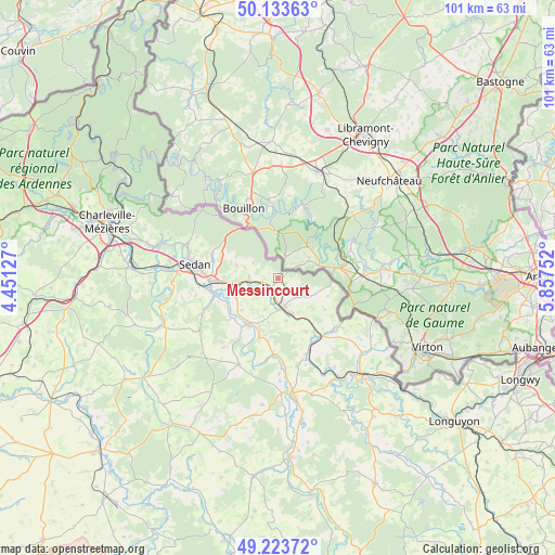
Messincourt GPS coordinates[2]
49° 40' 50.88" North, 5° 9' 15.84" East
| Map corner | latitude | longitude |
|---|---|---|
| Upper-left | 50.13363°, | 4.45127° |
| Center: | 49.6808°, | 5.1544° |
| Lower-right: | 49.22372°, | 5.85752° |
| Map W x H: | 101.2×101.2 km | = 62.9×62.9mi |
| max Lat: | 51.07786° ⇑8.6% North |
| Messincourt: | 49.6808° |
| min Lat: | ⇓91.4% South 41.3874° |
| min Long | Messincourt | max Long |
| -5.08615° | 5.1544° | 9.52242° |
| W 79.3%⇐ | ⇒20.7% E |
Elevation
Elevation of Messincourt is 224 m = 735 ft, and this is 30.3 m = 99 ft above average elevation for this country.
| Max E: |
2333 m = 7654 ft | 29% |
| Messincourt | 224 m 735 ft | |
| Avg. | 193.7 m = 635 ft | |
Min E: |
-1 m = -3 ft | 71% |
See also: France elevation on elevation.city.
Geographical zone
Messincourt is located in North temperate zone (between Tropic of Cancer and the Arctic Circle). Distance of this North polar circle is 1877.2 km =1166.4 mi to North.| Distance of | km | miles | from Messincourt |
|---|---|---|---|
| North Pole | 4483.1 | 2785.7 | to North |
| Arctic Circle | 1877.2 | 1166.4 | to North |
| Tropic Cancer | 2918.1 | 1813.2 | to South |
| Equator | 5524 | 3432.5 | to South |


Nearby cities:
15 places around Messincourt: (largest is in red/bold)
• Balan
13.7 km =8.5 mi,  273°
273°
• Bazeilles
12.7 km =7.9 mi, 267°
• Blagny
7.1 km =4.4 mi,  157°
157°
• Carignan
5.6 km =3.5 mi,  169°
169°
• Douzy
8.2 km =5.1 mi,  262°
262°
• Francheval
7.9 km =4.9 mi,  286°
286°
• Givonne
12.8 km =8 mi, 290°
• Haraucourt
15.3 km =9.5 mi,  245°
245°
• Margut
13.3 km =8.3 mi,  145°
145°
• Mouzon
10 km =6.2 mi,  214°
214°
• Pouru-Saint-Remy
5.1 km =3.2 mi, 273°
• Pure
1.7 km =1.1 mi,  116°
116°
• Remilly-Aillicourt
12 km =7.5 mi, 254°
• Sedan
15.6 km =9.7 mi,  278°
278°
• Wadelincourt
15.4 km =9.6 mi, 271°
Sources, notices
• [Note1] Compared only with cities in France existing in our database
• [Src1] Map data: © OpenStreetMap contributors (CC-BY-SA)
• [Src2] Other city data from geonames.org with taken over terms of usage.
• [Src3] Geographical zone / Annual Mean Temperature by Robert A. Rohde @ Wikipedia
