Mercy-le-Bas geodata
Mercy-le-Bas (Grand Est) is a populated place; located in France in Europe/Paris (GMT+2) time zone. With population of 1,351 people, there are 6807 cities with bigger population in this country. Compared to other cities in France, 87.7% of cities are located further ↓South; 84.7% of cities are located further ←West and 81% of cities have lower elevation than Mercy-le-Bas. Note1
Administrative division(s):
- Level 1: Grand Est
- Level 2: Meurthe-et-Moselle
- Level 3: Arrondissement de Briey
- Level 4: Mercy-le-Bas


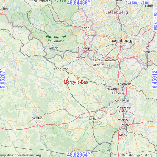
Mercy-le-Bas GPS coordinates[2]
49° 23' 21.66" North, 5° 45' 21.564" East
| Map corner | latitude | longitude |
|---|---|---|
| Upper-left | 49.84489°, | 5.05287° |
| Center: | 49.38935°, | 5.75599° |
| Lower-right: | 48.92954°, | 6.45912° |
| Map W x H: | 101.8×101.8 km | = 63.3×63.3mi |
| max Lat: | 51.07786° ⇑12.3% North |
| Mercy-le-Bas: | 49.38935° |
| min Lat: | ⇓87.7% South 41.3874° |
| min Long | Mercy-le-Bas | max Long |
| -5.08615° | 5.75599° | 9.52242° |
| W 84.7%⇐ | ⇒15.3% E |
Elevation
Elevation of Mercy-le-Bas is 300 m = 984 ft, and this is 106.3 m = 349 ft above average elevation for this country.
| Max E: |
2333 m = 7654 ft | 19% |
| Mercy-le-Bas | 300 m 984 ft | |
| Avg. | 193.7 m = 635 ft | |
Min E: |
-1 m = -3 ft | 81% |
See also: France elevation on elevation.city.
Geographical zone
Mercy-le-Bas is located in North temperate zone (between Tropic of Cancer and the Arctic Circle). Distance of this North polar circle is 1909.6 km =1186.6 mi to North.| Distance of | km | miles | from Mercy-le-Bas |
|---|---|---|---|
| North Pole | 4515.5 | 2805.8 | to North |
| Arctic Circle | 1909.6 | 1186.6 | to North |
| Tropic Cancer | 2885.7 | 1793.1 | to South |
| Equator | 5491.6 | 3412.3 | to South |


Nearby cities:
15 places around Mercy-le-Bas: (largest is in red/bold)
• Audun-le-Roman
10.3 km =6.4 mi,  102°
102°
• Baslieux
4.9 km =3 mi,  2°
2°
• Beuveille
6.9 km =4.3 mi,  315°
315°
• Bouligny
10.9 km =6.8 mi,  185°
185°
• Chenières
9.3 km =5.8 mi, 4°
• Cutry
10.5 km =6.5 mi,  355°
355°
• Landres
8.3 km =5.2 mi,  157°
157°
• Mont-Bonvillers
9 km =5.6 mi,  140°
140°
• Morfontaine
7.3 km =4.5 mi,  32°
32°
• Piennes
9 km =5.6 mi,  168°
168°
• Pierrepont
4.5 km =2.8 mi,  311°
311°
• Serrouville
9.6 km =6 mi,  83°
83°
• Spincourt
9.2 km =5.7 mi,  224°
224°
• Ugny
10.1 km =6.3 mi,  335°
335°
• Villers-la-Montagne
10.4 km =6.5 mi, 28°
Sources, notices
• [Note1] Compared only with cities in France existing in our database
• [Src1] Map data: © OpenStreetMap contributors (CC-BY-SA)
• [Src2] Other city data from geonames.org with taken over terms of usage.
• [Src3] Geographical zone / Annual Mean Temperature by Robert A. Rohde @ Wikipedia
