Landres geodata
Landres (Grand Est) is a populated place; located in France in Europe/Paris (GMT+2) time zone. With population of 1,021 people, there are 8676 cities with bigger population in this country. Compared to other cities in France, 86.5% of cities are located further ↓South; 85.1% of cities are located further ←West and 81.9% of cities have lower elevation than Landres. Note1
Administrative division(s):
- Level 1: Grand Est
- Level 2: Meurthe-et-Moselle
- Level 3: Arrondissement de Briey
- Level 4: Landres


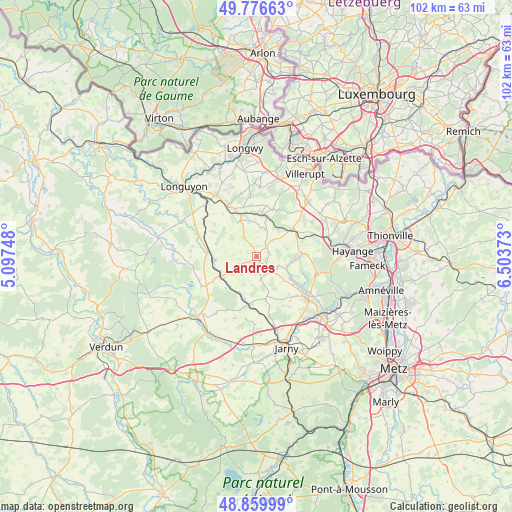
Landres GPS coordinates[2]
49° 19' 13.584" North, 5° 48' 2.16" East
| Map corner | latitude | longitude |
|---|---|---|
| Upper-left | 49.77663°, | 5.09748° |
| Center: | 49.32044°, | 5.8006° |
| Lower-right: | 48.85999°, | 6.50373° |
| Map W x H: | 101.9×101.9 km | = 63.3×63.3mi |
| max Lat: | 51.07786° ⇑13.5% North |
| Landres: | 49.32044° |
| min Lat: | ⇓86.5% South 41.3874° |
| min Long | Landres | max Long |
| -5.08615° | 5.8006° | 9.52242° |
| W 85.1%⇐ | ⇒14.9% E |
Elevation
Elevation of Landres is 310 m = 1017 ft, and this is 116.3 m = 382 ft above average elevation for this country.
| Max E: |
2333 m = 7654 ft | 18.1% |
| Landres | 310 m 1017 ft | |
| Avg. | 193.7 m = 635 ft | |
Min E: |
-1 m = -3 ft | 81.9% |
See also: France elevation on elevation.city.
Geographical zone
Landres is located in North temperate zone (between Tropic of Cancer and the Arctic Circle). Distance of this North polar circle is 1917.3 km =1191.4 mi to North.| Distance of | km | miles | from Landres |
|---|---|---|---|
| North Pole | 4523.1 | 2810.5 | to North |
| Arctic Circle | 1917.3 | 1191.4 | to North |
| Tropic Cancer | 2878 | 1788.3 | to South |
| Equator | 5483.9 | 3407.5 | to South |


Nearby cities:
15 places around Landres: (largest is in red/bold)
• Audun-le-Roman
8.8 km =5.5 mi,  51°
51°
• Avril
12.5 km =7.8 mi,  107°
107°
• Bouligny
5.3 km =3.3 mi,  233°
233°
• Dommary-Baroncourt
8.1 km =5 mi,  239°
239°
• Joudreville
3.6 km =2.2 mi,  205°
205°
• Lantéfontaine
11 km =6.8 mi,  136°
136°
• Mance
10.2 km =6.3 mi,  124°
124°
• Mancieulles
8.1 km =5 mi, 121°
• Mercy-le-Bas
8.3 km =5.2 mi,  337°
337°
• Mont-Bonvillers
2.6 km =1.6 mi,  73°
73°
• Piennes
1.9 km =1.2 mi, 231°
• Serrouville
10.8 km =6.7 mi,  36°
36°
• Spincourt
9.8 km =6.1 mi,  276°
276°
• Trieux
9.4 km =5.8 mi,  87°
87°
• Tucquegnieux
6.9 km =4.3 mi,  99°
99°
Sources, notices
• [Note1] Compared only with cities in France existing in our database
• [Src1] Map data: © OpenStreetMap contributors (CC-BY-SA)
• [Src2] Other city data from geonames.org with taken over terms of usage.
• [Src3] Geographical zone / Annual Mean Temperature by Robert A. Rohde @ Wikipedia
