Meisenthal geodata
Meisenthal (Grand Est) is a populated place; located in France in Europe/Paris (GMT+2) time zone. With population of 790 people, there are 10715 cities with bigger population in this country. Compared to other cities in France, 79% of cities are located further ↓South; 96.9% of cities are located further ←West and 84.8% of cities have lower elevation than Meisenthal. Note1
Administrative division(s):
- Level 1: Grand Est
- Level 2: Moselle
- Level 3: Arrondissement de Sarreguemines
- Level 4: Meisenthal


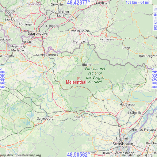
Meisenthal GPS coordinates[2]
48° 58' 9.588" North, 7° 21' 11.232" East
| Map corner | latitude | longitude |
|---|---|---|
| Upper-left | 49.42877°, | 6.64999° |
| Center: | 48.96933°, | 7.35312° |
| Lower-right: | 48.50562°, | 8.05624° |
| Map W x H: | 102.6×102.6 km | = 63.8×63.8mi |
| max Lat: | 51.07786° ⇑21% North |
| Meisenthal: | 48.96933° |
| min Lat: | ⇓79% South 41.3874° |
| min Long | Meisenthal | max Long |
| -5.08615° | 7.35312° | 9.52242° |
| W 96.9%⇐ | ⇒3.1% E |
Elevation
Elevation of Meisenthal is 343 m = 1125 ft, and this is 149.3 m = 490 ft above average elevation for this country.
| Max E: |
2333 m = 7654 ft | 15.2% |
| Meisenthal | 343 m 1125 ft | |
| Avg. | 193.7 m = 635 ft | |
Min E: |
-1 m = -3 ft | 84.8% |
See also: France elevation on elevation.city.
Geographical zone
Meisenthal is located in North temperate zone (between Tropic of Cancer and the Arctic Circle). Distance of this North polar circle is 1956.3 km =1215.6 mi to North.| Distance of | km | miles | from Meisenthal |
|---|---|---|---|
| North Pole | 4562.2 | 2834.8 | to North |
| Arctic Circle | 1956.3 | 1215.6 | to North |
| Tropic Cancer | 2839 | 1764.1 | to South |
| Equator | 5444.9 | 3383.3 | to South |


Nearby cities:
15 places around Meisenthal: (largest is in red/bold)
• Butten
9.5 km =5.9 mi,  270°
270°
• Enchenberg
5 km =3.1 mi,  347°
347°
• Goetzenbruck
2.1 km =1.3 mi,  64°
64°
• Lambach
7.3 km =4.5 mi,  3°
3°
• Lemberg
4.1 km =2.5 mi,  27°
27°
• Montbronn
4 km =2.5 mi,  309°
309°
• Petit-Réderching
10.1 km =6.3 mi,  340°
340°
• Reipertswiller
9 km =5.6 mi,  116°
116°
• Rosteig
4.2 km =2.6 mi,  194°
194°
• Saint-Louis-lès-Bitche
2.1 km =1.3 mi,  359°
359°
• Siersthal
8.2 km =5.1 mi, 357°
• Soucht
1.8 km =1.1 mi,  230°
230°
• Weislingen
9.1 km =5.7 mi, 233°
• Wimmenau
8.1 km =5 mi,  141°
141°
• Wingen-sur-Moder
5.9 km =3.7 mi,  160°
160°
Sources, notices
• [Note1] Compared only with cities in France existing in our database
• [Src1] Map data: © OpenStreetMap contributors (CC-BY-SA)
• [Src2] Other city data from geonames.org with taken over terms of usage.
• [Src3] Geographical zone / Annual Mean Temperature by Robert A. Rohde @ Wikipedia
