Marchaux geodata
Marchaux (Bourgogne-Franche-Comté) is a populated place; located in France in Europe/Paris (GMT+2) time zone. With population of 975 people, there are 9023 cities with bigger population in this country. Compared to other cities in France, 51.2% of cities are located further ↑North; 88.6% of cities are located further ←West and 79.9% of cities have lower elevation than Marchaux. Note1
Administrative division(s):
- Level 1: Bourgogne-Franche-Comté
- Level 2: Doubs
- Level 3: Arrondissement de Besançon
- Level 4: Marchaux-Chaudefontaine


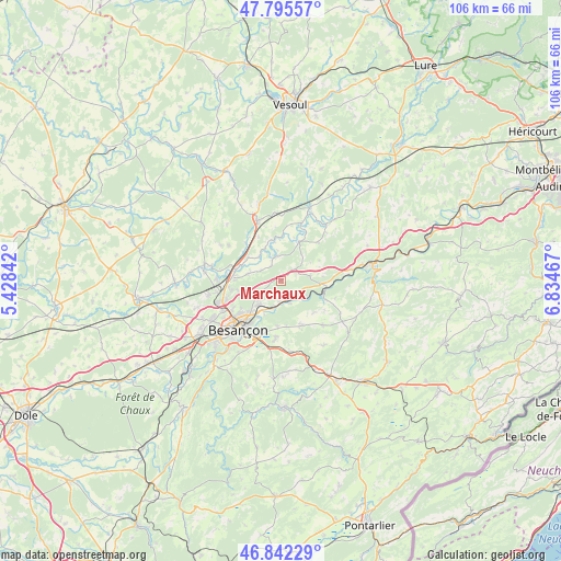
Marchaux GPS coordinates[2]
47° 19' 15.888" North, 6° 7' 53.544" East
| Map corner | latitude | longitude |
|---|---|---|
| Upper-left | 47.79557°, | 5.42842° |
| Center: | 47.32108°, | 6.13154° |
| Lower-right: | 46.84229°, | 6.83467° |
| Map W x H: | 106×106 km | = 65.9×65.9mi |
| max Lat: | 51.07786° ⇑51.2% North |
| Marchaux: | 47.32108° |
| min Lat: | ⇓48.8% South 41.3874° |
| min Long | Marchaux | max Long |
| -5.08615° | 6.13154° | 9.52242° |
| W 88.6%⇐ | ⇒11.4% E |
Elevation
Elevation of Marchaux is 289 m = 948 ft, and this is 95.3 m = 313 ft above average elevation for this country.
| Max E: |
2333 m = 7654 ft | 20.1% |
| Marchaux | 289 m 948 ft | |
| Avg. | 193.7 m = 635 ft | |
Min E: |
-1 m = -3 ft | 79.9% |
See also: France elevation on elevation.city.
Geographical zone
Marchaux is located in North temperate zone (between Tropic of Cancer and the Arctic Circle). Distance of this North polar circle is 2139.6 km =1329.5 mi to North.| Distance of | km | miles | from Marchaux |
|---|---|---|---|
| North Pole | 4745.5 | 2948.7 | to North |
| Arctic Circle | 2139.6 | 1329.5 | to North |
| Tropic Cancer | 2655.7 | 1650.2 | to South |
| Equator | 5261.6 | 3269.4 | to South |


Nearby cities:
15 places around Marchaux: (largest is in red/bold)
• Amagney
2.3 km =1.4 mi,  140°
140°
• Bonnay
6.3 km =3.9 mi,  282°
282°
• Chalezeule
8.2 km =5.1 mi,  211°
211°
• Châtillon-le-Duc
9.5 km =5.9 mi,  259°
259°
• Deluz
6.1 km =3.8 mi,  119°
119°
• Devecey
8.5 km =5.3 mi,  270°
270°
• Gennes
8 km =5 mi,  188°
188°
• Lusans
6.5 km =4 mi,  56°
56°
• Montfaucon
10.2 km =6.3 mi,  201°
201°
• Nancray
9.3 km =5.8 mi,  155°
155°
• Novillars
4.1 km =2.5 mi,  182°
182°
• Roche-lez-Beaupré
4.3 km =2.7 mi, 194°
• Roulans
7.4 km =4.6 mi,  94°
94°
• Thise
5.5 km =3.4 mi,  223°
223°
• Vieilley
4.2 km =2.6 mi,  293°
293°
Sources, notices
• [Note1] Compared only with cities in France existing in our database
• [Src1] Map data: © OpenStreetMap contributors (CC-BY-SA)
• [Src2] Other city data from geonames.org with taken over terms of usage.
• [Src3] Geographical zone / Annual Mean Temperature by Robert A. Rohde @ Wikipedia
