Deluz geodata
Deluz (Bourgogne-Franche-Comté) is a populated place; located in France in Europe/Paris (GMT+2) time zone. With population of 724 people, there are 11480 cities with bigger population in this country. Compared to other cities in France, 51.6% of cities are located further ↑North; 89.3% of cities are located further ←West and 76.1% of cities have lower elevation than Deluz. Note1
Administrative division(s):
- Level 1: Bourgogne-Franche-Comté
- Level 2: Doubs
- Level 3: Arrondissement de Besançon
- Level 4: Deluz


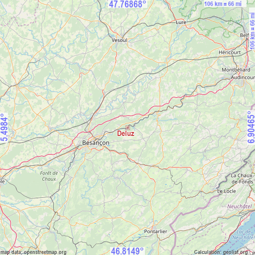
Deluz GPS coordinates[2]
47° 17' 38.184" North, 6° 12' 5.508" East
| Map corner | latitude | longitude |
|---|---|---|
| Upper-left | 47.76868°, | 5.4984° |
| Center: | 47.29394°, | 6.20153° |
| Lower-right: | 46.8149°, | 6.90465° |
| Map W x H: | 106.1×10⁶ km | = 65.9×65.9mi |
| max Lat: | 51.07786° ⇑51.6% North |
| Deluz: | 47.29394° |
| min Lat: | ⇓48.4% South 41.3874° |
| min Long | Deluz | max Long |
| -5.08615° | 6.20153° | 9.52242° |
| W 89.3%⇐ | ⇒10.7% E |
Elevation
Elevation of Deluz is 257 m = 843 ft, and this is 63.3 m = 208 ft above average elevation for this country.
| Max E: |
2333 m = 7654 ft | 23.9% |
| Deluz | 257 m 843 ft | |
| Avg. | 193.7 m = 635 ft | |
Min E: |
-1 m = -3 ft | 76.1% |
See also: France elevation on elevation.city.
Geographical zone
Deluz is located in North temperate zone (between Tropic of Cancer and the Arctic Circle). Distance of this North polar circle is 2142.6 km =1331.3 mi to North.| Distance of | km | miles | from Deluz |
|---|---|---|---|
| North Pole | 4748.5 | 2950.6 | to North |
| Arctic Circle | 2142.6 | 1331.3 | to North |
| Tropic Cancer | 2652.7 | 1648.3 | to South |
| Equator | 5258.6 | 3267.5 | to South |


Nearby cities:
15 places around Deluz: (largest is in red/bold)
• Amagney
4 km =2.5 mi,  288°
288°
• Bouclans
6 km =3.7 mi,  152°
152°
• Chalezeule
10.3 km =6.4 mi,  247°
247°
• Gennes
8.1 km =5 mi,  232°
232°
• Lusans
6.6 km =4.1 mi,  1°
1°
• Mamirolle
11.1 km =6.9 mi,  196°
196°
• Marchaux
6.1 km =3.8 mi,  299°
299°
• Naisey-les-Granges
9.3 km =5.8 mi,  156°
156°
• Nancray
5.6 km =3.5 mi,  194°
194°
• Novillars
5.6 km =3.5 mi,  259°
259°
• Roche-lez-Beaupré
6.5 km =4 mi, 259°
• Roulans
3.2 km =2 mi,  40°
40°
• Saône
10.1 km =6.3 mi,  219°
219°
• Thise
9.1 km =5.7 mi, 263°
• Vieilley
10.3 km =6.4 mi, 297°
Sources, notices
• [Note1] Compared only with cities in France existing in our database
• [Src1] Map data: © OpenStreetMap contributors (CC-BY-SA)
• [Src2] Other city data from geonames.org with taken over terms of usage.
• [Src3] Geographical zone / Annual Mean Temperature by Robert A. Rohde @ Wikipedia
