Lussant geodata
Lussant (Nouvelle-Aquitaine) is a populated place; located in France in Europe/Paris (GMT+2) time zone. With population of 911 people, there are 9566 cities with bigger population in this country. Compared to other cities in France, 66.7% of cities are located further ↑North; 86.7% of cities are located further →East and 96.7% of cities have higher elevation than Lussant. Note1
Administrative division(s):
- Level 1: Nouvelle-Aquitaine
- Level 2: Charente-Maritime
- Level 3: Arrondissement de Rochefort
- Level 4: Lussant


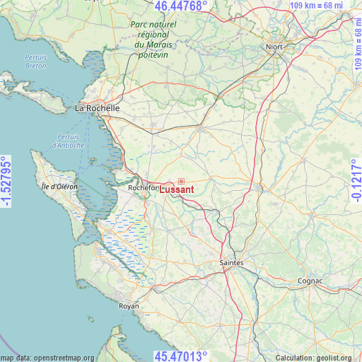
Lussant GPS coordinates[2]
45° 57' 39.816" North, 0° 49' 29.388" West
| Map corner | latitude | longitude |
|---|---|---|
| Upper-left | 46.44768°, | -1.52795° |
| Center: | 45.96106°, | -0.82483° |
| Lower-right: | 45.47013°, | -0.1217° |
| Map W x H: | 108.7×108.7 km | = 67.5×67.5mi |
| max Lat: | 51.07786° ⇑66.7% North |
| Lussant: | 45.96106° |
| min Lat: | ⇓33.3% South 41.3874° |
| min Long | Lussant | max Long |
| -5.08615° | -0.82483° | 9.52242° |
| W 13.3%⇐ | ⇒86.7% E |
Elevation
Elevation of Lussant is 12 m = 39 ft, and this is 181.7 m = 596 ft below average elevation for this country.
| Max E: |
2333 m = 7654 ft | 96.7% |
| Avg. | 193.7 m = 635 ft | |
| Lussant | 12 m = 39 ft | |
Min E: |
-1 m = -3 ft | 3.3% |
See also: France elevation on elevation.city.
Geographical zone
Lussant is located in North temperate zone (between Tropic of Cancer and the Arctic Circle). Distance of this North polar circle is 2290.8 km =1423.4 mi to North.| Distance of | km | miles | from Lussant |
|---|---|---|---|
| North Pole | 4896.7 | 3042.7 | to North |
| Arctic Circle | 2290.8 | 1423.4 | to North |
| Tropic Cancer | 2504.5 | 1556.2 | to South |
| Equator | 5110.4 | 3175.5 | to South |


Nearby cities:
15 places around Lussant: (largest is in red/bold)
• Archingeay
9.8 km =6.1 mi,  109°
109°
• Beurlay
11.2 km =7 mi,  184°
184°
• Bords
7.5 km =4.7 mi,  162°
162°
• Breuil-Magné
10.8 km =6.7 mi,  284°
284°
• Cabariot
4.6 km =2.9 mi,  213°
213°
• Geay
11 km =6.8 mi, 155°
• Genouillé
7.5 km =4.7 mi,  24°
24°
• La Vallée
7.9 km =4.9 mi,  188°
188°
• Muron
8.2 km =5.1 mi,  357°
357°
• Rochefort
11.2 km =7 mi,  259°
259°
• Romegoux
10 km =6.2 mi,  171°
171°
• Saint-Hippolyte
7 km =4.3 mi,  227°
227°
• Tonnay-Boutonne
9 km =5.6 mi,  84°
84°
• Tonnay-Charente
5.5 km =3.4 mi, 255°
• Trizay
10.3 km =6.4 mi, 212°
Sources, notices
• [Note1] Compared only with cities in France existing in our database
• [Src1] Map data: © OpenStreetMap contributors (CC-BY-SA)
• [Src2] Other city data from geonames.org with taken over terms of usage.
• [Src3] Geographical zone / Annual Mean Temperature by Robert A. Rohde @ Wikipedia
