Longuyon geodata
Longuyon (Grand Est) is a populated place; located in France in Europe/Paris (GMT+2) time zone. With population of 5,773 people, there are 1707 cities with bigger population in this country. Compared to other cities in France, 88.5% of cities are located further ↓South; 83.8% of cities are located further ←West and 80.7% of cities have lower elevation than Longuyon. Note1
Administrative division(s):
- Level 1: Grand Est
- Level 2: Meurthe-et-Moselle
- Level 3: Arrondissement de Briey
- Level 4: Longuyon


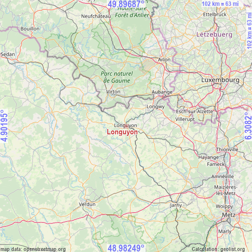
Longuyon GPS coordinates[2]
49° 26' 30.516" North, 5° 36' 18.288" East
| Map corner | latitude | longitude |
|---|---|---|
| Upper-left | 49.89687°, | 4.90195° |
| Center: | 49.44181°, | 5.60508° |
| Lower-right: | 48.98249°, | 6.3082° |
| Map W x H: | 101.7×101.7 km | = 63.2×63.2mi |
| max Lat: | 51.07786° ⇑11.5% North |
| Longuyon: | 49.44181° |
| min Lat: | ⇓88.5% South 41.3874° |
| min Long | Longuyon | max Long |
| -5.08615° | 5.60508° | 9.52242° |
| W 83.8%⇐ | ⇒16.2% E |
Elevation
Elevation of Longuyon is 298 m = 978 ft, and this is 104.3 m = 342 ft above average elevation for this country.
| Max E: |
2333 m = 7654 ft | 19.3% |
| Longuyon | 298 m 978 ft | |
| Avg. | 193.7 m = 635 ft | |
Min E: |
-1 m = -3 ft | 80.7% |
See also: France elevation on elevation.city.
Geographical zone
Longuyon is located in North temperate zone (between Tropic of Cancer and the Arctic Circle). Distance of this North polar circle is 1903.8 km =1183 mi to North.| Distance of | km | miles | from Longuyon |
|---|---|---|---|
| North Pole | 4509.6 | 2802.1 | to North |
| Arctic Circle | 1903.8 | 1183 | to North |
| Tropic Cancer | 2891.5 | 1796.7 | to South |
| Equator | 5497.4 | 3415.9 | to South |


Nearby cities:
15 places around Longuyon: (largest is in red/bold)
• Allondrelle
8.4 km =5.2 mi,  338°
338°
• Baslieux
11.1 km =6.9 mi,  94°
94°
• Beuveille
6.1 km =3.8 mi,  98°
98°
• Cons-la-Grandville
8.6 km =5.3 mi,  56°
56°
• Cosnes
11.6 km =7.2 mi,  41°
41°
• Cutry
11 km =6.8 mi,  65°
65°
• Gorcy
11.8 km =7.3 mi,  29°
29°
• Lexy
11.1 km =6.9 mi,  54°
54°
• Marville
10.9 km =6.8 mi,  276°
276°
• Pierrepont
8 km =5 mi,  110°
110°
• Tellancourt
7.6 km =4.7 mi,  15°
15°
• Ugny
7.4 km =4.6 mi, 63°
• Ville-Houdlémont
12 km =7.5 mi,  14°
14°
• Villers-la-Chèvre
9.5 km =5.9 mi, 43°
• Viviers-sur-Chiers
4 km =2.5 mi, 30°
Sources, notices
• [Note1] Compared only with cities in France existing in our database
• [Src1] Map data: © OpenStreetMap contributors (CC-BY-SA)
• [Src2] Other city data from geonames.org with taken over terms of usage.
• [Src3] Geographical zone / Annual Mean Temperature by Robert A. Rohde @ Wikipedia
