Leymen geodata
Leymen (Grand Est) is a populated place; located in France in Europe/Paris (GMT+2) time zone. With population of 1,099 people, there are 8139 cities with bigger population in this country. Compared to other cities in France, 51.1% of cities are located further ↓South; 97.9% of cities are located further ←West and 85.5% of cities have lower elevation than Leymen. Note1
Administrative division(s):
- Level 1: Grand Est
- Level 2: Haut-Rhin
- Level 3: Arrondissement de Mulhouse
- Level 4: Leymen


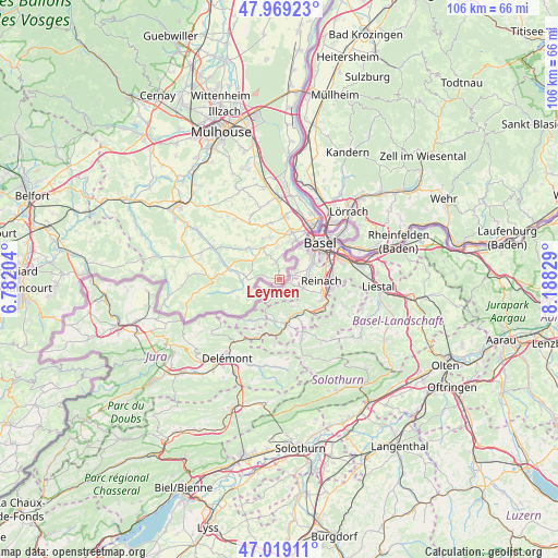
Leymen GPS coordinates[2]
47° 29' 46.752" North, 7° 29' 6.612" East
| Map corner | latitude | longitude |
|---|---|---|
| Upper-left | 47.96923°, | 6.78204° |
| Center: | 47.49632°, | 7.48517° |
| Lower-right: | 47.01911°, | 8.18829° |
| Map W x H: | 105.6×105.6 km | = 65.6×65.6mi |
| max Lat: | 51.07786° ⇑48.9% North |
| Leymen: | 47.49632° |
| min Lat: | ⇓51.1% South 41.3874° |
| min Long | Leymen | max Long |
| -5.08615° | 7.48517° | 9.52242° |
| W 97.9%⇐ | ⇒2.1% E |
Elevation
Elevation of Leymen is 353 m = 1158 ft, and this is 159.3 m = 523 ft above average elevation for this country.
| Max E: |
2333 m = 7654 ft | 14.5% |
| Leymen | 353 m 1158 ft | |
| Avg. | 193.7 m = 635 ft | |
Min E: |
-1 m = -3 ft | 85.5% |
See also: France elevation on elevation.city.
Geographical zone
Leymen is located in North temperate zone (between Tropic of Cancer and the Arctic Circle). Distance of this North polar circle is 2120.1 km =1317.4 mi to North.| Distance of | km | miles | from Leymen |
|---|---|---|---|
| North Pole | 4726 | 2936.6 | to North |
| Arctic Circle | 2120.1 | 1317.4 | to North |
| Tropic Cancer | 2675.2 | 1662.3 | to South |
| Equator | 5281.1 | 3281.5 | to South |


Nearby cities:
15 places around Leymen: (largest is in red/bold)
• Attenschwiller
8 km =5 mi,  348°
348°
• Buschwiller
7.1 km =4.4 mi,  13°
13°
• Durmenach
11.5 km =7.1 mi,  288°
288°
• Folgensbourg
6.6 km =4.1 mi,  333°
333°
• Hagenthal-le-Bas
3.2 km =2 mi, 350°
• Hégenheim
8 km =5 mi,  21°
21°
• Hésingue
9.5 km =5.9 mi, 15°
• Michelbach-le-Bas
10.8 km =6.7 mi, 352°
• Muespach-le-Haut
8.4 km =5.2 mi,  312°
312°
• Neuwiller
3.8 km =2.4 mi,  34°
34°
• Oltingue
7 km =4.3 mi,  265°
265°
• Raedersdorf
9.3 km =5.8 mi,  254°
254°
• Ranspach-le-Bas
10.5 km =6.5 mi,  343°
343°
• Wentzwiller
6.1 km =3.8 mi,  355°
355°
• Werentzhouse
10.1 km =6.3 mi,  283°
283°
Sources, notices
• [Note1] Compared only with cities in France existing in our database
• [Src1] Map data: © OpenStreetMap contributors (CC-BY-SA)
• [Src2] Other city data from geonames.org with taken over terms of usage.
• [Src3] Geographical zone / Annual Mean Temperature by Robert A. Rohde @ Wikipedia
