Muespach-le-Haut geodata
Muespach-le-Haut (Grand Est) is a populated place; located in France in Europe/Paris (GMT+2) time zone. With population of 849 people, there are 10089 cities with bigger population in this country. Compared to other cities in France, 51.9% of cities are located further ↓South; 97.3% of cities are located further ←West and 90.9% of cities have lower elevation than Muespach-le-Haut. Note1
Administrative division(s):
- Level 1: Grand Est
- Level 2: Haut-Rhin
- Level 3: Altkirch
- Level 4: Muespach-le-Haut


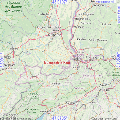
Muespach-le-Haut GPS coordinates[2]
47° 32' 50.1" North, 7° 24' 8.028" East
| Map corner | latitude | longitude |
|---|---|---|
| Upper-left | 48.0197°, | 6.69911° |
| Center: | 47.54725°, | 7.40223° |
| Lower-right: | 47.0705°, | 8.10536° |
| Map W x H: | 105.5×105.5 km | = 65.6×65.6mi |
| max Lat: | 51.07786° ⇑48.1% North |
| Muespach-le-Haut: | 47.54725° |
| min Lat: | ⇓51.9% South 41.3874° |
| min Long | Muespach-le-Hau | max Long |
| -5.08615° | 7.40223° | 9.52242° |
| W 97.3%⇐ | ⇒2.7% E |
Elevation
Elevation of Muespach-le-Haut is 448 m = 1470 ft, and this is 254.3 m = 834 ft above average elevation for this country.
| Max E: |
2333 m = 7654 ft | 9.1% |
| Muespach-le-Haut | 448 m 1470 ft | |
| Avg. | 193.7 m = 635 ft | |
Min E: |
-1 m = -3 ft | 90.9% |
See also: France elevation on elevation.city.
Geographical zone
Muespach-le-Haut is located in North temperate zone (between Tropic of Cancer and the Arctic Circle). Distance of this North polar circle is 2114.4 km =1313.8 mi to North.| Distance of | km | miles | from Muespach-le-Haut |
|---|---|---|---|
| North Pole | 4720.3 | 2933.1 | to North |
| Arctic Circle | 2114.4 | 1313.8 | to North |
| Tropic Cancer | 2680.8 | 1665.8 | to South |
| Equator | 5286.8 | 3285.1 | to South |


Nearby cities:
15 places around Muespach-le-Haut: (largest is in red/bold)
• Attenschwiller
5.1 km =3.2 mi,  64°
64°
• Durmenach
5.2 km =3.2 mi,  246°
246°
• Folgensbourg
3.3 km =2.1 mi,  85°
85°
• Hagenthal-le-Bas
6.2 km =3.9 mi,  113°
113°
• Helfrantzkirch
6.7 km =4.2 mi,  8°
8°
• Jettingen
6.1 km =3.8 mi,  338°
338°
• Michelbach-le-Bas
6.9 km =4.3 mi,  43°
43°
• Oberdorf
7.4 km =4.6 mi,  280°
280°
• Oltingue
6.3 km =3.9 mi,  187°
187°
• Ranspach-le-Bas
5.5 km =3.4 mi, 36°
• Roppentzwiller
5.4 km =3.4 mi,  262°
262°
• Steinsoultz
4.9 km =3 mi, 275°
• Waldighofen
6.5 km =4 mi,  273°
273°
• Wentzwiller
5.8 km =3.6 mi, 86°
• Werentzhouse
4.8 km =3 mi,  227°
227°
Sources, notices
• [Note1] Compared only with cities in France existing in our database
• [Src1] Map data: © OpenStreetMap contributors (CC-BY-SA)
• [Src2] Other city data from geonames.org with taken over terms of usage.
• [Src3] Geographical zone / Annual Mean Temperature by Robert A. Rohde @ Wikipedia
