Les Magnils-Reigniers geodata
Les Magnils-Reigniers (Pays de la Loire) is a populated place; located in France in Europe/Paris (GMT+2) time zone. With population of 1,443 people, there are 6415 cities with bigger population in this country. Compared to other cities in France, 60.3% of cities are located further ↑North; 90.1% of cities are located further →East and 93.6% of cities have higher elevation than Les Magnils-Reigniers. Note1
Administrative division(s):
- Level 1: Pays de la Loire
- Level 2: Département de la Vendée
- Level 3: Arrondissement de Fontenay-le-Comte
- Level 4: Les Magnils-Reigniers
Current local time in Les Magnils-Reigniers:
01:30 PM, SaturdayDifference from your time zone: hours


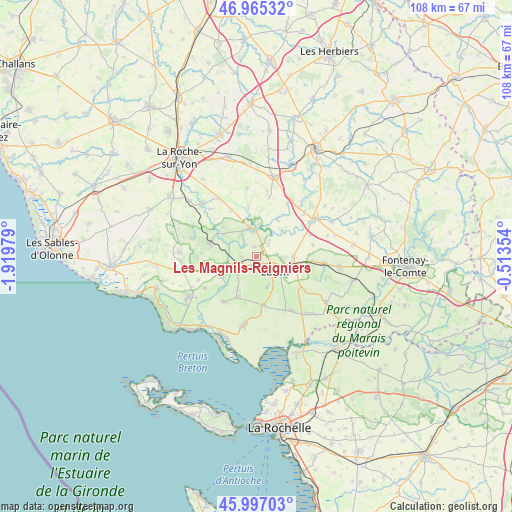
Les Magnils-Reigniers GPS coordinates[2]
46° 28' 59.988" North, 1° 13' 0.012" West
| Map corner | latitude | longitude |
|---|---|---|
| Upper-left | 46.96532°, | -1.91979° |
| Center: | 46.48333°, | -1.21667° |
| Lower-right: | 45.99703°, | -0.51354° |
| Map W x H: | 107.7×107.7 km | = 66.9×66.9mi |
| max Lat: | 51.07786° ⇑60.3% North |
| Les Magnils-Reigniers: | 46.48333° |
| min Lat: | ⇓39.7% South 41.3874° |
| min Long | Les Magnils-Rei | max Long |
| -5.08615° | -1.21667° | 9.52242° |
| W 9.9%⇐ | ⇒90.1% E |
Elevation
Elevation of Les Magnils-Reigniers is 21 m = 69 ft, and this is 172.7 m = 567 ft below average elevation for this country.
| Max E: |
2333 m = 7654 ft | 93.6% |
| Avg. | 193.7 m = 635 ft | |
| Les Magnils-Reigniers | 21 m = 69 ft | |
Min E: |
-1 m = -3 ft | 6.4% |
See also: France elevation on elevation.city.
Geographical zone
Les Magnils-Reigniers is located in North temperate zone (between Tropic of Cancer and the Arctic Circle). Distance of this North polar circle is 2232.7 km =1387.3 mi to North.| Distance of | km | miles | from Les Magnils-Reigniers |
|---|---|---|---|
| North Pole | 4838.6 | 3006.6 | to North |
| Arctic Circle | 2232.7 | 1387.3 | to North |
| Tropic Cancer | 2562.5 | 1592.3 | to South |
| Equator | 5168.5 | 3211.6 | to South |


Nearby cities:
15 places around Les Magnils-Reigniers: (largest is in red/bold)
• Champagné-les-Marais
13.5 km =8.4 mi,  147°
147°
• Chasnais
2.8 km =1.7 mi,  200°
200°
• Château-Guibert
11 km =6.8 mi,  352°
352°
• Corpe
3.5 km =2.2 mi,  47°
47°
• Grues
11.6 km =7.2 mi,  215°
215°
• Lairoux
5.5 km =3.4 mi, 223°
• Le Champ-Saint-Père
10.4 km =6.5 mi,  285°
285°
• Luçon
4.9 km =3 mi,  125°
125°
• Mareuil-sur-Lay-Dissais
5.7 km =3.5 mi, 347°
• Moutiers-sur-le-Lay
9.1 km =5.7 mi,  29°
29°
• Péault
2.1 km =1.3 mi, 351°
• Saint-Florent-des-Bois
14.4 km =8.9 mi,  328°
328°
• Saint-Vincent-sur-Graon
13.7 km =8.5 mi, 285°
• Sainte-Gemme-la-Plaine
7.9 km =4.9 mi,  90°
90°
• Triaize
10.2 km =6.3 mi,  171°
171°
Sources, notices
• [Note1] Compared only with cities in France existing in our database
• [Src1] Map data: © OpenStreetMap contributors (CC-BY-SA)
• [Src2] Other city data from geonames.org with taken over terms of usage.
• [Src3] Geographical zone / Annual Mean Temperature by Robert A. Rohde @ Wikipedia
