Le Champ-Saint-Père geodata
Le Champ-Saint-Père (Pays de la Loire) is a populated place; located in France in Europe/Paris (GMT+2) time zone. With population of 1,404 people, there are 6592 cities with bigger population in this country. Compared to other cities in France, 60% of cities are located further ↑North; 91.2% of cities are located further →East and 89.5% of cities have higher elevation than Le Champ-Saint-Père. Note1
Administrative division(s):
- Level 1: Pays de la Loire
- Level 2: Département de la Vendée
- Level 3: Arrondissement des Sables-d'Olonne
- Level 4: Le Champ-Saint-Père


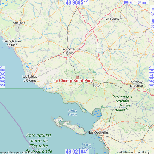
Le Champ-Saint-Père GPS coordinates[2]
46° 30' 27.828" North, 1° 20' 50.136" West
| Map corner | latitude | longitude |
|---|---|---|
| Upper-left | 46.98951°, | -2.05039° |
| Center: | 46.50773°, | -1.34726° |
| Lower-right: | 46.02164°, | -0.64414° |
| Map W x H: | 107.6×107.6 km | = 66.9×66.9mi |
| max Lat: | 51.07786° ⇑60% North |
| Le Champ-Saint-Père: | 46.50773° |
| min Lat: | ⇓40% South 41.3874° |
| min Long | Le Champ-Saint- | max Long |
| -5.08615° | -1.34726° | 9.52242° |
| W 8.8%⇐ | ⇒91.2% E |
Elevation
Elevation of Le Champ-Saint-Père is 31 m = 102 ft, and this is 162.7 m = 534 ft below average elevation for this country.
| Max E: |
2333 m = 7654 ft | 89.5% |
| Avg. | 193.7 m = 635 ft | |
| Le Champ-Saint-Père | 31 m = 102 ft | |
Min E: |
-1 m = -3 ft | 10.5% |
See also: France elevation on elevation.city.
Geographical zone
Le Champ-Saint-Père is located in North temperate zone (between Tropic of Cancer and the Arctic Circle). Distance of this North polar circle is 2230 km =1385.7 mi to North.| Distance of | km | miles | from Le Champ-Saint-Père |
|---|---|---|---|
| North Pole | 4835.9 | 3004.9 | to North |
| Arctic Circle | 2230 | 1385.7 | to North |
| Tropic Cancer | 2565.3 | 1594 | to South |
| Equator | 5171.2 | 3213.2 | to South |


Nearby cities:
15 places around Le Champ-Saint-Père: (largest is in red/bold)
• Angles
11.9 km =7.4 mi,  201°
201°
• Avrillé
11.1 km =6.9 mi,  246°
246°
• Chasnais
10.5 km =6.5 mi,  120°
120°
• Château-Guibert
11.8 km =7.3 mi,  46°
46°
• La Boissière-des-Landes
10.8 km =6.7 mi,  305°
305°
• Lairoux
9.2 km =5.7 mi,  137°
137°
• Le Bernard
12.2 km =7.6 mi,  230°
230°
• Les Magnils-Reigniers
10.4 km =6.5 mi,  105°
105°
• Mareuil-sur-Lay-Dissais
9.2 km =5.7 mi,  71°
71°
• Moutiers-les-Mauxfaits
6 km =3.7 mi,  242°
242°
• Nesmy
10.1 km =6.3 mi,  336°
336°
• Péault
9.7 km =6 mi,  93°
93°
• Saint-Avaugourd-des-Landes
10.5 km =6.5 mi,  273°
273°
• Saint-Florent-des-Bois
9.9 km =6.2 mi,  14°
14°
• Saint-Vincent-sur-Graon
3.3 km =2.1 mi,  287°
287°
Sources, notices
• [Note1] Compared only with cities in France existing in our database
• [Src1] Map data: © OpenStreetMap contributors (CC-BY-SA)
• [Src2] Other city data from geonames.org with taken over terms of usage.
• [Src3] Geographical zone / Annual Mean Temperature by Robert A. Rohde @ Wikipedia
