Le Boulay-Morin geodata
Le Boulay-Morin (Normandy) is a populated place; located in France in Europe/Paris (GMT+2) time zone. With population of 591 people, there are 13465 cities with bigger population in this country. Compared to other cities in France, 81.8% of cities are located further ↓South; 67% of cities are located further →East and 53.6% of cities have lower elevation than Le Boulay-Morin. Note1
Administrative division(s):
- Level 1: Normandy
- Level 2: Département de l'Eure
- Level 3: Arrondissement d’Évreux
- Level 4: Le Boulay-Morin


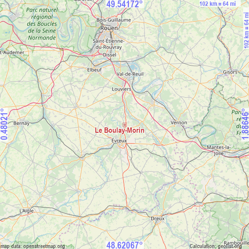
Le Boulay-Morin GPS coordinates[2]
49° 4' 59.988" North, 1° 10' 59.988" East
| Map corner | latitude | longitude |
|---|---|---|
| Upper-left | 49.54172°, | 0.48021° |
| Center: | 49.08333°, | 1.18333° |
| Lower-right: | 48.62067°, | 1.88646° |
| Map W x H: | 102.4×102.4 km | = 63.6×63.6mi |
| max Lat: | 51.07786° ⇑18.2% North |
| Le Boulay-Morin: | 49.08333° |
| min Lat: | ⇓81.8% South 41.3874° |
| min Long | Le Boulay-Morin | max Long |
| -5.08615° | 1.18333° | 9.52242° |
| W 33%⇐ | ⇒67% E |
Elevation
Elevation of Le Boulay-Morin is 145 m = 476 ft, and this is 48.7 m = 160 ft below average elevation for this country.
| Max E: |
2333 m = 7654 ft | 46.4% |
| Avg. | 193.7 m = 635 ft | |
| Le Boulay-Morin | 145 m = 476 ft | |
Min E: |
-1 m = -3 ft | 53.6% |
See also: France elevation on elevation.city.
Geographical zone
Le Boulay-Morin is located in North temperate zone (between Tropic of Cancer and the Arctic Circle). Distance of this North polar circle is 1943.6 km =1207.7 mi to North.| Distance of | km | miles | from Le Boulay-Morin |
|---|---|---|---|
| North Pole | 4549.5 | 2826.9 | to North |
| Arctic Circle | 1943.6 | 1207.7 | to North |
| Tropic Cancer | 2851.6 | 1771.9 | to South |
| Equator | 5457.6 | 3391.2 | to South |


Nearby cities:
15 places around Le Boulay-Morin: (largest is in red/bold)
• Amfreville-sur-Iton
7.4 km =4.6 mi,  341°
341°
• Aviron
6.1 km =3.8 mi,  232°
232°
• Brosville
5.2 km =3.2 mi,  290°
290°
• Fontaine-Heudebourg
5.7 km =3.5 mi,  23°
23°
• Gauciel
7 km =4.3 mi,  142°
142°
• Gravigny
3.5 km =2.2 mi,  196°
196°
• Heudreville-sur-Eure
6.4 km =4 mi,  3°
3°
• Huest
5.2 km =3.2 mi,  162°
162°
• La Croix-Saint-Leufroy
5.2 km =3.2 mi,  56°
56°
• La Vacherie
6.6 km =4.1 mi,  323°
323°
• Normanville
1.8 km =1.1 mi,  253°
253°
• Reuilly
3.1 km =1.9 mi,  101°
101°
• Écardenville-sur-Eure
6.6 km =4.1 mi,  72°
72°
• Émalleville
2.3 km =1.4 mi,  313°
313°
• Évreux
7 km =4.3 mi, 199°
Sources, notices
• [Note1] Compared only with cities in France existing in our database
• [Src1] Map data: © OpenStreetMap contributors (CC-BY-SA)
• [Src2] Other city data from geonames.org with taken over terms of usage.
• [Src3] Geographical zone / Annual Mean Temperature by Robert A. Rohde @ Wikipedia
