Lavardin geodata
Lavardin (Pays de la Loire) is a populated place; located in France in Europe/Paris (GMT+2) time zone. With population of 687 people, there are 11986 cities with bigger population in this country. Compared to other cities in France, 60.7% of cities are located further ↓South; 77.6% of cities are located further →East and 57.9% of cities have higher elevation than Lavardin. Note1
Administrative division(s):
- Level 1: Pays de la Loire
- Level 2: Sarthe
- Level 3: Arrondissement de Mamers
- Level 4: Lavardin


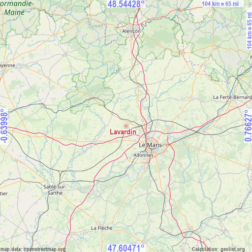
Lavardin GPS coordinates[2]
48° 4' 35.904" North, 0° 3' 47.304" East
| Map corner | latitude | longitude |
|---|---|---|
| Upper-left | 48.54428°, | -0.63998° |
| Center: | 48.07664°, | 0.06314° |
| Lower-right: | 47.60471°, | 0.76627° |
| Map W x H: | 104.5×104.5 km | = 64.9×64.9mi |
| max Lat: | 51.07786° ⇑39.3% North |
| Lavardin: | 48.07664° |
| min Lat: | ⇓60.7% South 41.3874° |
| min Long | Lavardin | max Long |
| -5.08615° | 0.06314° | 9.52242° |
| W 22.4%⇐ | ⇒77.6% E |
Elevation
Elevation of Lavardin is 108 m = 354 ft, and this is 85.7 m = 281 ft below average elevation for this country.
| Max E: |
2333 m = 7654 ft | 57.9% |
| Avg. | 193.7 m = 635 ft | |
| Lavardin | 108 m = 354 ft | |
Min E: |
-1 m = -3 ft | 42.1% |
See also: France elevation on elevation.city.
Geographical zone
Lavardin is located in North temperate zone (between Tropic of Cancer and the Arctic Circle). Distance of this North polar circle is 2055.6 km =1277.3 mi to North.| Distance of | km | miles | from Lavardin |
|---|---|---|---|
| North Pole | 4661.4 | 2896.5 | to North |
| Arctic Circle | 2055.6 | 1277.3 | to North |
| Tropic Cancer | 2739.7 | 1702.4 | to South |
| Equator | 5345.6 | 3321.6 | to South |


Nearby cities:
15 places around Lavardin: (largest is in red/bold)
• Aigné
4.4 km =2.7 mi,  107°
107°
• Chaufour-Notre-Dame
5.7 km =3.5 mi,  171°
171°
• Conlie
7.9 km =4.9 mi,  310°
310°
• Coulans-sur-Gée
7.4 km =4.6 mi,  212°
212°
• Degré
3.1 km =1.9 mi, 173°
• Domfront-en-Champagne
4 km =2.5 mi,  320°
320°
• La Bazoge
7.2 km =4.5 mi,  71°
71°
• La Chapelle-Saint-Aubin
8.3 km =5.2 mi,  123°
123°
• La Milesse
5.5 km =3.4 mi, 105°
• La Quinte
2.7 km =1.7 mi,  222°
222°
• Neuville-sur-Sarthe
9.6 km =6 mi,  90°
90°
• Rouillon
9.5 km =5.9 mi,  145°
145°
• Saint-Saturnin
6.9 km =4.3 mi, 107°
• Sainte-Sabine-sur-Longève
7.5 km =4.7 mi,  18°
18°
• Trangé
6.5 km =4 mi, 147°
Sources, notices
• [Note1] Compared only with cities in France existing in our database
• [Src1] Map data: © OpenStreetMap contributors (CC-BY-SA)
• [Src2] Other city data from geonames.org with taken over terms of usage.
• [Src3] Geographical zone / Annual Mean Temperature by Robert A. Rohde @ Wikipedia
