La Penne-sur-Huveaune geodata
La Penne-sur-Huveaune (Provence-Alpes-Côte d'Azur) is a populated place; located in France in Europe/Paris (GMT+2) time zone. With population of 6,253 people, there are 1586 cities with bigger population in this country. Compared to other cities in France, 96.1% of cities are located further ↑North; 83% of cities are located further ←West and 69.7% of cities have higher elevation than La Penne-sur-Huveaune. Note1
Administrative division(s):
- Level 1: Provence-Alpes-Côte d'Azur
- Level 2: Département des Bouches-du-Rhône
- Level 3: Arrondissement de Marseille
- Level 4: La Penne-sur-Huveaune


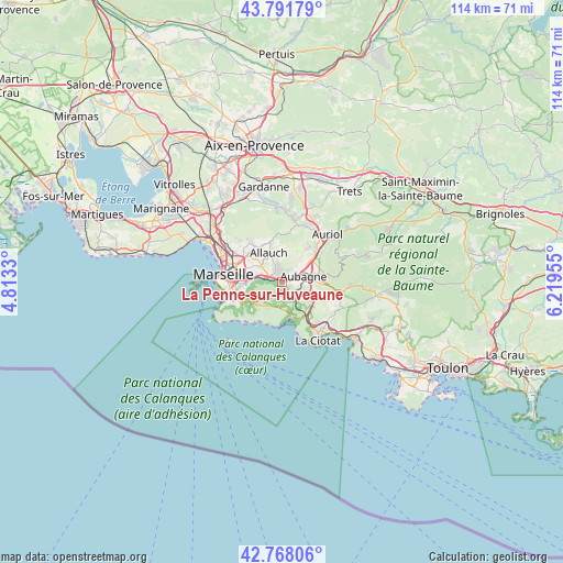
La Penne-sur-Huveaune GPS coordinates[2]
43° 16' 55.488" North, 5° 30' 59.112" East
| Map corner | latitude | longitude |
|---|---|---|
| Upper-left | 43.79179°, | 4.8133° |
| Center: | 43.28208°, | 5.51642° |
| Lower-right: | 42.76806°, | 6.21955° |
| Map W x H: | 113.8×113.8 km | = 70.7×70.7mi |
| max Lat: | 51.07786° ⇑96.1% North |
| La Penne-sur-Huveaune: | 43.28208° |
| min Lat: | ⇓3.9% South 41.3874° |
| min Long | La Penne-sur-Hu | max Long |
| -5.08615° | 5.51642° | 9.52242° |
| W 83%⇐ | ⇒17% E |
Elevation
Elevation of La Penne-sur-Huveaune is 79 m = 259 ft, and this is 114.7 m = 376 ft below average elevation for this country.
| Max E: |
2333 m = 7654 ft | 69.7% |
| Avg. | 193.7 m = 635 ft | |
| La Penne-sur-Huveaune | 79 m = 259 ft | |
Min E: |
-1 m = -3 ft | 30.3% |
See also: France elevation on elevation.city.
Geographical zone
La Penne-sur-Huveaune is located in North temperate zone (between Tropic of Cancer and the Arctic Circle). Distance of this Northern Tropic circle is 2206.6 km =1371.1 mi to South.| Distance of | km | miles | from La Penne-sur-Huveaune |
|---|---|---|---|
| North Pole | 5194.5 | 3227.7 | to North |
| Arctic Circle | 2588.7 | 1608.5 | to North |
| Tropic Cancer | 2206.6 | 1371.1 | to South |
| Equator | 4812.5 | 2990.3 | to South |


Nearby cities:
15 places around La Penne-sur-Huveaune: (largest is in red/bold)
• Aubagne
4.5 km =2.8 mi,  74°
74°
• Carnoux-en-Provence
4.8 km =3 mi,  126°
126°
• La Barasse
2.4 km =1.5 mi,  275°
275°
• La Millère
1.5 km =0.9 mi,  266°
266°
• La Pomme
6.1 km =3.8 mi, 278°
• La Treille
3.6 km =2.2 mi,  351°
351°
• La Valbarelle
5.1 km =3.2 mi, 273°
• La Valentine
3.1 km =1.9 mi,  303°
303°
• Les Accates
2.5 km =1.6 mi,  321°
321°
• Les Caillols
6 km =3.7 mi,  292°
292°
• Les Camoins
2.7 km =1.7 mi,  1°
1°
• Les Trois-Lucs
5.6 km =3.5 mi,  308°
308°
• Saint-Marcel
4.1 km =2.5 mi, 278°
• Saint-Menet
1.3 km =0.8 mi, 311°
• Éoures
2.1 km =1.3 mi,  12°
12°
Sources, notices
• [Note1] Compared only with cities in France existing in our database
• [Src1] Map data: © OpenStreetMap contributors (CC-BY-SA)
• [Src2] Other city data from geonames.org with taken over terms of usage.
• [Src3] Geographical zone / Annual Mean Temperature by Robert A. Rohde @ Wikipedia
