Les Trois-Lucs geodata
Les Trois-Lucs (Provence-Alpes-Côte d'Azur) is a section of populated place; located in France in Europe/Paris (GMT+2) time zone. With population of 5,117 people, there are 1922 cities with bigger population in this country. Compared to other cities in France, 95.4% of cities are located further ↑North; 82.6% of cities are located further ←West and 62.1% of cities have lower elevation than Les Trois-Lucs. Note1
Administrative division(s):
- Level 1: Provence-Alpes-Côte d'Azur
- Level 2: Département des Bouches-du-Rhône
- Level 3: Arrondissement de Marseille
- Level 4: Marseille


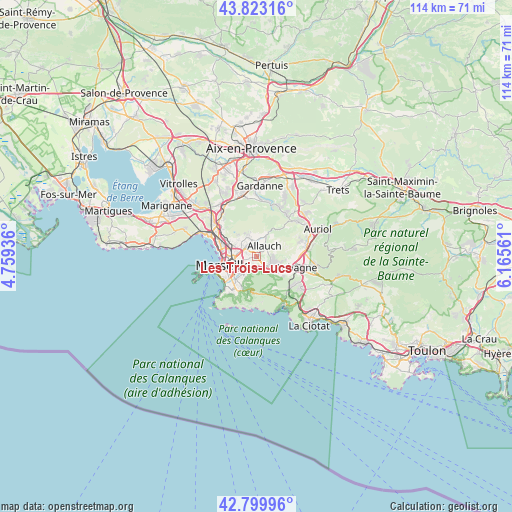
Les Trois-Lucs GPS coordinates[2]
43° 18' 49.356" North, 5° 27' 44.928" East
| Map corner | latitude | longitude |
|---|---|---|
| Upper-left | 43.82316°, | 4.75936° |
| Center: | 43.31371°, | 5.46248° |
| Lower-right: | 42.79996°, | 6.16561° |
| Map W x H: | 113.8×113.8 km | = 70.7×70.7mi |
| max Lat: | 51.07786° ⇑95.4% North |
| Les Trois-Lucs: | 43.31371° |
| min Lat: | ⇓4.6% South 41.3874° |
| min Long | Les Trois-Lucs | max Long |
| -5.08615° | 5.46248° | 9.52242° |
| W 82.6%⇐ | ⇒17.4% E |
Elevation
Elevation of Les Trois-Lucs is 180 m = 591 ft, and this is 13.7 m = 45 ft below average elevation for this country.
| Max E: |
2333 m = 7654 ft | 37.9% |
| Avg. | 193.7 m = 635 ft | |
| Les Trois-Lucs | 180 m = 591 ft | |
Min E: |
-1 m = -3 ft | 62.1% |
See also: France elevation on elevation.city.
Geographical zone
Les Trois-Lucs is located in North temperate zone (between Tropic of Cancer and the Arctic Circle). Distance of this Northern Tropic circle is 2210.1 km =1373.3 mi to South.| Distance of | km | miles | from Les Trois-Lucs |
|---|---|---|---|
| North Pole | 5191 | 3225.5 | to North |
| Arctic Circle | 2585.1 | 1606.3 | to North |
| Tropic Cancer | 2210.1 | 1373.3 | to South |
| Equator | 4816 | 2992.5 | to South |


Nearby cities:
15 places around Les Trois-Lucs: (largest is in red/bold)
• Allauch
2.9 km =1.8 mi,  32°
32°
• La Croix-Rouge
2.3 km =1.4 mi,  342°
342°
• La Fourragère
2.7 km =1.7 mi,  246°
246°
• La Pomme
3.1 km =1.9 mi,  212°
212°
• La Rose
3.2 km =2 mi,  301°
301°
• La Valbarelle
3.3 km =2.1 mi,  192°
192°
• La Valentine
2.5 km =1.6 mi,  135°
135°
• Les Accates
3.2 km =2 mi,  118°
118°
• Les Caillols
1.7 km =1.1 mi,  222°
222°
• Les Olives
1.2 km =0.7 mi, 343°
• Marseille 11
3.2 km =2 mi, 217°
• Marseille 12
2.9 km =1.8 mi,  227°
227°
• Montolivet
3.2 km =2 mi,  276°
276°
• Saint-Julien
1.1 km =0.7 mi,  267°
267°
• Saint-Marcel
2.9 km =1.8 mi,  174°
174°
Sources, notices
• [Note1] Compared only with cities in France existing in our database
• [Src1] Map data: © OpenStreetMap contributors (CC-BY-SA)
• [Src2] Other city data from geonames.org with taken over terms of usage.
• [Src3] Geographical zone / Annual Mean Temperature by Robert A. Rohde @ Wikipedia
