Éoures geodata
Éoures (Provence-Alpes-Côte d'Azur) is a section of populated place; located in France in Europe/Paris (GMT+2) time zone. With population of 1,453 people, there are 6358 cities with bigger population in this country. Compared to other cities in France, 95.6% of cities are located further ↑North; 83.1% of cities are located further ←West and 54.7% of cities have lower elevation than Éoures. Note1
Administrative division(s):
- Level 1: Provence-Alpes-Côte d'Azur
- Level 2: Département des Bouches-du-Rhône
- Level 3: Arrondissement de Marseille
- Level 4: Marseille


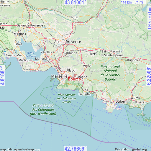
Éoures GPS coordinates[2]
43° 18' 1.62" North, 5° 31' 18.948" East
| Map corner | latitude | longitude |
|---|---|---|
| Upper-left | 43.81001°, | 4.81881° |
| Center: | 43.30045°, | 5.52193° |
| Lower-right: | 42.78659°, | 6.22506° |
| Map W x H: | 113.8×113.8 km | = 70.7×70.7mi |
| max Lat: | 51.07786° ⇑95.6% North |
| Éoures: | 43.30045° |
| min Lat: | ⇓4.4% South 41.3874° |
| min Long | Éoures | max Long |
| -5.08615° | 5.52193° | 9.52242° |
| W 83.1%⇐ | ⇒16.9% E |
Elevation
Elevation of Éoures is 149 m = 489 ft, and this is 44.7 m = 147 ft below average elevation for this country.
| Max E: |
2333 m = 7654 ft | 45.3% |
| Avg. | 193.7 m = 635 ft | |
| Éoures | 149 m = 489 ft | |
Min E: |
-1 m = -3 ft | 54.7% |
See also: France elevation on elevation.city.
Geographical zone
Éoures is located in North temperate zone (between Tropic of Cancer and the Arctic Circle). Distance of this Northern Tropic circle is 2208.6 km =1372.4 mi to South.| Distance of | km | miles | from Éoures |
|---|---|---|---|
| North Pole | 5192.5 | 3226.5 | to North |
| Arctic Circle | 2586.6 | 1607.2 | to North |
| Tropic Cancer | 2208.6 | 1372.4 | to South |
| Equator | 4814.6 | 2991.7 | to South |


Nearby cities:
15 places around Éoures: (largest is in red/bold)
• Allauch
5.1 km =3.2 mi,  320°
320°
• Aubagne
4 km =2.5 mi,  102°
102°
• Carnoux-en-Provence
6 km =3.7 mi,  144°
144°
• La Barasse
3.4 km =2.1 mi,  237°
237°
• La Millère
2.9 km =1.8 mi,  222°
222°
• La Penne-sur-Huveaune
2.1 km =1.3 mi,  192°
192°
• La Treille
1.8 km =1.1 mi,  326°
326°
• La Valbarelle
5.8 km =3.6 mi,  252°
252°
• La Valentine
3.1 km =1.9 mi,  263°
263°
• Les Accates
2 km =1.2 mi,  268°
268°
• Les Camoins
0.7 km =0.4 mi, 329°
• Les Olives
5.8 km =3.6 mi,  296°
296°
• Les Trois-Lucs
5 km =3.1 mi,  287°
287°
• Saint-Marcel
4.7 km =2.9 mi, 252°
• Saint-Menet
1.8 km =1.1 mi,  230°
230°
Sources, notices
• [Note1] Compared only with cities in France existing in our database
• [Src1] Map data: © OpenStreetMap contributors (CC-BY-SA)
• [Src2] Other city data from geonames.org with taken over terms of usage.
• [Src3] Geographical zone / Annual Mean Temperature by Robert A. Rohde @ Wikipedia
