Lanne geodata
Lanne (Occitanie) is a populated place; located in France in Europe/Paris (GMT+2) time zone. With population of 572 people, there are 13802 cities with bigger population in this country. Compared to other cities in France, 97.5% of cities are located further ↑North; 78.1% of cities are located further →East and 86.9% of cities have lower elevation than Lanne. Note1
Administrative division(s):
- Level 1: Occitanie
- Level 2: Département des Hautes-Pyrénées
- Level 3: Arrondissement de Tarbes
- Level 4: Lanne


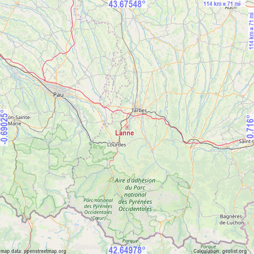
Lanne GPS coordinates[2]
43° 9' 53.208" North, 0° 0' 46.368" East
| Map corner | latitude | longitude |
|---|---|---|
| Upper-left | 43.67548°, | -0.69025° |
| Center: | 43.16478°, | 0.01288° |
| Lower-right: | 42.64978°, | 0.716° |
| Map W x H: | 114×114 km | = 70.8×70.8mi |
| max Lat: | 51.07786° ⇑97.5% North |
| Lanne: | 43.16478° |
| min Lat: | ⇓2.5% South 41.3874° |
| min Long | Lanne | max Long |
| -5.08615° | 0.01288° | 9.52242° |
| W 21.9%⇐ | ⇒78.1% E |
Elevation
Elevation of Lanne is 372 m = 1220 ft, and this is 178.3 m = 585 ft above average elevation for this country.
| Max E: |
2333 m = 7654 ft | 13.1% |
| Lanne | 372 m 1220 ft | |
| Avg. | 193.7 m = 635 ft | |
Min E: |
-1 m = -3 ft | 86.9% |
See also: France elevation on elevation.city.
Geographical zone
Lanne is located in North temperate zone (between Tropic of Cancer and the Arctic Circle). Distance of this Northern Tropic circle is 2193.6 km =1363 mi to South.| Distance of | km | miles | from Lanne |
|---|---|---|---|
| North Pole | 5207.6 | 3235.9 | to North |
| Arctic Circle | 2601.7 | 1616.6 | to North |
| Tropic Cancer | 2193.6 | 1363 | to South |
| Equator | 4799.5 | 2982.3 | to South |


Nearby cities:
15 places around Lanne: (largest is in red/bold)
• Adé
5.1 km =3.2 mi,  226°
226°
• Azereix
6.2 km =3.9 mi,  337°
337°
• Bernac-Debat
7.7 km =4.8 mi,  87°
87°
• Bénac
1.6 km =1 mi,  142°
142°
• Horgues
6.6 km =4.1 mi,  66°
66°
• Ibos
7.7 km =4.8 mi,  352°
352°
• Juillan
4 km =2.5 mi,  15°
15°
• Laloubère
6.6 km =4.1 mi,  47°
47°
• Louey
1.4 km =0.9 mi, 23°
• Lourdes
8.8 km =5.5 mi,  215°
215°
• Momères
6.4 km =4 mi,  76°
76°
• Odos
5 km =3.1 mi, 45°
• Ossun
4.3 km =2.7 mi,  298°
298°
• Poueyferré
8.4 km =5.2 mi, 230°
• Soues
8.4 km =5.2 mi,  55°
55°
Sources, notices
• [Note1] Compared only with cities in France existing in our database
• [Src1] Map data: © OpenStreetMap contributors (CC-BY-SA)
• [Src2] Other city data from geonames.org with taken over terms of usage.
• [Src3] Geographical zone / Annual Mean Temperature by Robert A. Rohde @ Wikipedia
