La Chapelle-Chaussée geodata
La Chapelle-Chaussée (Brittany) is a populated place; located in France in Europe/Paris (GMT+2) time zone. With population of 837 people, there are 10216 cities with bigger population in this country. Compared to other cities in France, 64% of cities are located further ↓South; 94.3% of cities are located further →East and 51.7% of cities have higher elevation than La Chapelle-Chaussée. Note1
Administrative division(s):
- Level 1: Brittany
- Level 2: Département d'Ille-et-Vilaine
- Level 3: Arrondissement de Rennes
- Level 4: La Chapelle-Chaussée
Current local time in La Chapelle-Chaussée:
04:39 AM, WednesdayDifference from your time zone: hours


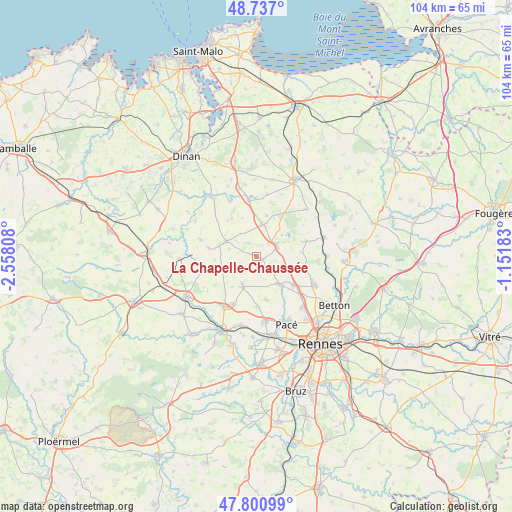
La Chapelle-Chaussée GPS coordinates[2]
48° 16' 16.104" North, 1° 51' 17.82" West
| Map corner | latitude | longitude |
|---|---|---|
| Upper-left | 48.737°, | -2.55808° |
| Center: | 48.27114°, | -1.85495° |
| Lower-right: | 47.80099°, | -1.15183° |
| Map W x H: | 104.1×104.1 km | = 64.7×64.7mi |
| max Lat: | 51.07786° ⇑36% North |
| La Chapelle-Chaussée: | 48.27114° |
| min Lat: | ⇓64% South 41.3874° |
| min Long | La Chapelle-Cha | max Long |
| -5.08615° | -1.85495° | 9.52242° |
| W 5.7%⇐ | ⇒94.3% E |
Elevation
Elevation of La Chapelle-Chaussée is 126 m = 413 ft, and this is 67.7 m = 222 ft below average elevation for this country.
| Max E: |
2333 m = 7654 ft | 51.7% |
| Avg. | 193.7 m = 635 ft | |
| La Chapelle-Chaussée | 126 m = 413 ft | |
Min E: |
-1 m = -3 ft | 48.3% |
See also: France elevation on elevation.city.
Geographical zone
La Chapelle-Chaussée is located in North temperate zone (between Tropic of Cancer and the Arctic Circle). Distance of this North polar circle is 2033.9 km =1263.8 mi to North.| Distance of | km | miles | from La Chapelle-Chaussée |
|---|---|---|---|
| North Pole | 4639.8 | 2883 | to North |
| Arctic Circle | 2033.9 | 1263.8 | to North |
| Tropic Cancer | 2761.3 | 1715.8 | to South |
| Equator | 5367.2 | 3335 | to South |


Nearby cities:
15 places around La Chapelle-Chaussée: (largest is in red/bold)
• Bécherel
7.2 km =4.5 mi,  292°
292°
• Gévezé
7.5 km =4.7 mi,  139°
139°
• Hédé-Bazouges
5.2 km =3.2 mi,  51°
51°
• Irodouër
7.4 km =4.6 mi,  250°
250°
• La Baussaine
5.7 km =3.5 mi,  325°
325°
• La Mézière
9.4 km =5.8 mi,  128°
128°
• Langan
2.9 km =1.8 mi,  176°
176°
• Langouet
3.3 km =2.1 mi, 136°
• Miniac-sous-Bécherel
5.8 km =3.6 mi, 285°
• Parthenay-de-Bretagne
9 km =5.6 mi,  167°
167°
• Québriac
8.4 km =5.2 mi,  14°
14°
• Romillé
6.7 km =4.2 mi,  204°
204°
• Saint-Gondran
1.4 km =0.9 mi,  109°
109°
• Tinténiac
6.5 km =4 mi, 12°
• Vignoc
6 km =3.7 mi, 114°
Sources, notices
• [Note1] Compared only with cities in France existing in our database
• [Src1] Map data: © OpenStreetMap contributors (CC-BY-SA)
• [Src2] Other city data from geonames.org with taken over terms of usage.
• [Src3] Geographical zone / Annual Mean Temperature by Robert A. Rohde @ Wikipedia
