Le Minihic-sur-Rance geodata
Le Minihic-sur-Rance (Brittany) is a populated place; located in France in Europe/Paris (GMT+2) time zone. With population of 1,303 people, there are 7015 cities with bigger population in this country. Compared to other cities in France, 70.3% of cities are located further ↓South; 94.9% of cities are located further →East and 90.3% of cities have higher elevation than Le Minihic-sur-Rance. Note1
Administrative division(s):
- Level 1: Brittany
- Level 2: Département d'Ille-et-Vilaine
- Level 3: Arrondissement de Saint-Malo
- Level 4: Le Minihic-sur-Rance
Current local time in Le Minihic-sur-Rance:
04:27 AM, WednesdayDifference from your time zone: hours


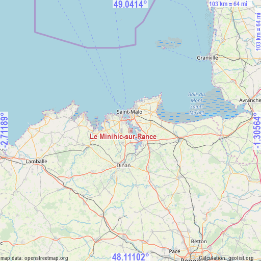
Le Minihic-sur-Rance GPS coordinates[2]
48° 34' 42.06" North, 2° 0' 31.536" West
| Map corner | latitude | longitude |
|---|---|---|
| Upper-left | 49.0414°, | -2.71189° |
| Center: | 48.57835°, | -2.00876° |
| Lower-right: | 48.11102°, | -1.30564° |
| Map W x H: | 103.4×103.4 km | = 64.2×64.2mi |
| max Lat: | 51.07786° ⇑29.7% North |
| Le Minihic-sur-Rance: | 48.57835° |
| min Lat: | ⇓70.3% South 41.3874° |
| min Long | Le Minihic-sur- | max Long |
| -5.08615° | -2.00876° | 9.52242° |
| W 5.1%⇐ | ⇒94.9% E |
Elevation
Elevation of Le Minihic-sur-Rance is 29 m = 95 ft, and this is 164.7 m = 540 ft below average elevation for this country.
| Max E: |
2333 m = 7654 ft | 90.3% |
| Avg. | 193.7 m = 635 ft | |
| Le Minihic-sur-Rance | 29 m = 95 ft | |
Min E: |
-1 m = -3 ft | 9.7% |
See also: France elevation on elevation.city.
Geographical zone
Le Minihic-sur-Rance is located in North temperate zone (between Tropic of Cancer and the Arctic Circle). Distance of this North polar circle is 1999.8 km =1242.6 mi to North.| Distance of | km | miles | from Le Minihic-sur-Rance |
|---|---|---|---|
| North Pole | 4605.7 | 2861.8 | to North |
| Arctic Circle | 1999.8 | 1242.6 | to North |
| Tropic Cancer | 2795.5 | 1737 | to South |
| Equator | 5401.4 | 3356.3 | to South |


Nearby cities:
15 places around Le Minihic-sur-Rance: (largest is in red/bold)
• Châteauneuf-d’Ille-et-Vilaine
6.2 km =3.9 mi,  108°
108°
• Dinard
7.1 km =4.4 mi,  326°
326°
• La Gouesnière
8.9 km =5.5 mi,  70°
70°
• La Richardais
3.7 km =2.3 mi, 326°
• La Ville-ès-Nonais
5.4 km =3.4 mi,  129°
129°
• Langrolay-sur-Rance
3.2 km =2 mi,  168°
168°
• Pleslin-Trigavou
6.6 km =4.1 mi,  220°
220°
• Pleudihen-sur-Rance
7.5 km =4.7 mi,  155°
155°
• Pleurtuit
3.6 km =2.2 mi,  270°
270°
• Plouër-sur-Rance
5.8 km =3.6 mi,  175°
175°
• Saint-Jouan-des-Guérets
3.5 km =2.2 mi,  47°
47°
• Saint-Malo
7.7 km =4.8 mi,  359°
359°
• Saint-Père
6.3 km =3.9 mi,  80°
80°
• Saint-Suliac
2.8 km =1.7 mi, 108°
• Tréméreuc
4.6 km =2.9 mi,  241°
241°
Sources, notices
• [Note1] Compared only with cities in France existing in our database
• [Src1] Map data: © OpenStreetMap contributors (CC-BY-SA)
• [Src2] Other city data from geonames.org with taken over terms of usage.
• [Src3] Geographical zone / Annual Mean Temperature by Robert A. Rohde @ Wikipedia
