La Meilleraye-de-Bretagne geodata
La Meilleraye-de-Bretagne (Pays de la Loire) is a populated place; located in France in Europe/Paris (GMT+2) time zone. With population of 1,113 people, there are 8050 cities with bigger population in this country. Compared to other cities in France, 52.1% of cities are located further ↓South; 91.5% of cities are located further →East and 66% of cities have higher elevation than La Meilleraye-de-Bretagne. Note1
Administrative division(s):
- Level 1: Pays de la Loire
- Level 2: Loire-Atlantique
- Level 3: Arrondissement of Châteaubriant-Ancenis
- Level 4: La Meilleraye-de-Bretagne
Current local time in La Meilleraye-de-Bretagne:
05:25 PM, SaturdayDifference from your time zone: hours


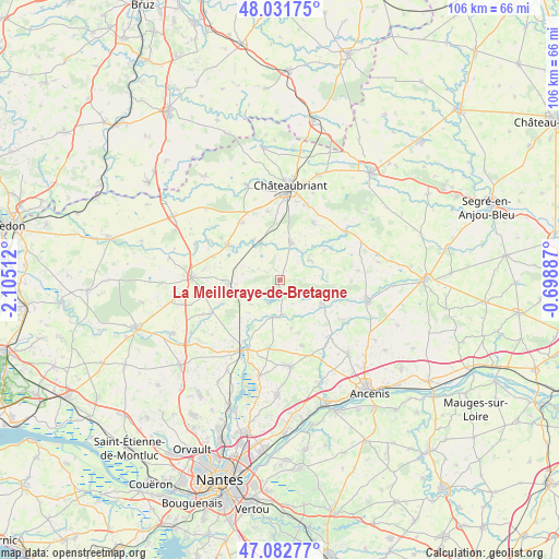
La Meilleraye-de-Bretagne GPS coordinates[2]
47° 33' 33.876" North, 1° 24' 7.2" West
| Map corner | latitude | longitude |
|---|---|---|
| Upper-left | 48.03175°, | -2.10512° |
| Center: | 47.55941°, | -1.402° |
| Lower-right: | 47.08277°, | -0.69887° |
| Map W x H: | 105.5×105.5 km | = 65.6×65.6mi |
| max Lat: | 51.07786° ⇑47.9% North |
| La Meilleraye-de-Bretagne: | 47.55941° |
| min Lat: | ⇓52.1% South 41.3874° |
| min Long | La Meilleraye-d | max Long |
| -5.08615° | -1.402° | 9.52242° |
| W 8.5%⇐ | ⇒91.5% E |
Elevation
Elevation of La Meilleraye-de-Bretagne is 87 m = 285 ft, and this is 106.7 m = 350 ft below average elevation for this country.
| Max E: |
2333 m = 7654 ft | 66% |
| Avg. | 193.7 m = 635 ft | |
| La Meilleraye-de-Bretagne | 87 m = 285 ft | |
Min E: |
-1 m = -3 ft | 34% |
See also: France elevation on elevation.city.
Geographical zone
La Meilleraye-de-Bretagne is located in North temperate zone (between Tropic of Cancer and the Arctic Circle). Distance of this North polar circle is 2113.1 km =1313 mi to North.| Distance of | km | miles | from La Meilleraye-de-Bretagne |
|---|---|---|---|
| North Pole | 4719 | 2932.2 | to North |
| Arctic Circle | 2113.1 | 1313 | to North |
| Tropic Cancer | 2682.2 | 1666.6 | to South |
| Equator | 5288.1 | 3285.9 | to South |


Nearby cities:
15 places around La Meilleraye-de-Bretagne: (largest is in red/bold)
• Abbaretz
9.8 km =6.1 mi,  265°
265°
• Bonnœuvre
13 km =8.1 mi,  102°
102°
• Bourg de Joué-sur-Erdre
7.2 km =4.5 mi,  191°
191°
• Erbray
12.4 km =7.7 mi,  30°
30°
• Issé
8.1 km =5 mi,  332°
332°
• Les Touches
13.2 km =8.2 mi, 189°
• Louisfert
13.1 km =8.1 mi,  349°
349°
• Moisdon-la-Rivière
7.3 km =4.5 mi,  17°
17°
• Mouzeil
13.1 km =8.1 mi,  161°
161°
• Pannecé
14.7 km =9.1 mi,  123°
123°
• Riaillé
9.3 km =5.8 mi, 119°
• Saint-Vincent-des-Landes
12.9 km =8 mi, 327°
• Teillé
14.3 km =8.9 mi,  139°
139°
• Trans-sur-Erdre
9.5 km =5.9 mi,  167°
167°
• Treffieux
12.2 km =7.6 mi,  303°
303°
Sources, notices
• [Note1] Compared only with cities in France existing in our database
• [Src1] Map data: © OpenStreetMap contributors (CC-BY-SA)
• [Src2] Other city data from geonames.org with taken over terms of usage.
• [Src3] Geographical zone / Annual Mean Temperature by Robert A. Rohde @ Wikipedia
