Erbray geodata
Erbray (Pays de la Loire) is a populated place; located in France in Europe/Paris (GMT+2) time zone. With population of 2,609 people, there are 3740 cities with bigger population in this country. Compared to other cities in France, 53.5% of cities are located further ↓South; 90.9% of cities are located further →East and 77.3% of cities have higher elevation than Erbray. Note1
Administrative division(s):
- Level 1: Pays de la Loire
- Level 2: Loire-Atlantique
- Level 3: Arrondissement of Châteaubriant-Ancenis
- Level 4: Erbray


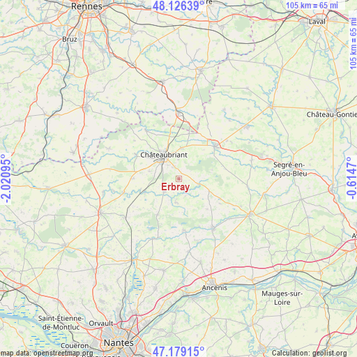
Erbray GPS coordinates[2]
47° 39' 17.712" North, 1° 19' 4.188" West
| Map corner | latitude | longitude |
|---|---|---|
| Upper-left | 48.12639°, | -2.02095° |
| Center: | 47.65492°, | -1.31783° |
| Lower-right: | 47.17915°, | -0.6147° |
| Map W x H: | 105.3×105.3 km | = 65.4×65.4mi |
| max Lat: | 51.07786° ⇑46.5% North |
| Erbray: | 47.65492° |
| min Lat: | ⇓53.5% South 41.3874° |
| min Long | Erbray | max Long |
| -5.08615° | -1.31783° | 9.52242° |
| W 9.1%⇐ | ⇒90.9% E |
Elevation
Elevation of Erbray is 61 m = 200 ft, and this is 132.7 m = 435 ft below average elevation for this country.
| Max E: |
2333 m = 7654 ft | 77.3% |
| Avg. | 193.7 m = 635 ft | |
| Erbray | 61 m = 200 ft | |
Min E: |
-1 m = -3 ft | 22.7% |
See also: France elevation on elevation.city.
Geographical zone
Erbray is located in North temperate zone (between Tropic of Cancer and the Arctic Circle). Distance of this North polar circle is 2102.4 km =1306.4 mi to North.| Distance of | km | miles | from Erbray |
|---|---|---|---|
| North Pole | 4708.3 | 2925.6 | to North |
| Arctic Circle | 2102.4 | 1306.4 | to North |
| Tropic Cancer | 2692.8 | 1673.2 | to South |
| Equator | 5298.7 | 3292.5 | to South |


Nearby cities:
15 places around Erbray: (largest is in red/bold)
• Bonnœuvre
14.9 km =9.3 mi,  154°
154°
• Châteaubriant
8.2 km =5.1 mi,  327°
327°
• Issé
10.6 km =6.6 mi,  251°
251°
• La Chapelle-Glain
9.9 km =6.2 mi,  111°
111°
• La Meilleraye-de-Bretagne
12.4 km =7.7 mi,  210°
210°
• Louisfert
8.9 km =5.5 mi,  284°
284°
• Moisdon-la-Rivière
5.5 km =3.4 mi,  228°
228°
• Noyal-sur-Brutz
13.5 km =8.4 mi,  350°
350°
• Pouancé
14.5 km =9 mi,  48°
48°
• Saint-Aubin-des-Châteaux
14.7 km =9.1 mi,  299°
299°
• Saint-Julien-de-Vouvantes
6 km =3.7 mi,  103°
103°
• Saint-Sulpice-des-Landes
12.1 km =7.5 mi,  136°
136°
• Saint-Vincent-des-Landes
13.3 km =8.3 mi,  270°
270°
• Soudan
9.3 km =5.8 mi,  5°
5°
• Villepot
13.7 km =8.5 mi, 12°
Sources, notices
• [Note1] Compared only with cities in France existing in our database
• [Src1] Map data: © OpenStreetMap contributors (CC-BY-SA)
• [Src2] Other city data from geonames.org with taken over terms of usage.
• [Src3] Geographical zone / Annual Mean Temperature by Robert A. Rohde @ Wikipedia
