Issé geodata
Issé (Pays de la Loire) is a populated place; located in France in Europe/Paris (GMT+2) time zone. With population of 1,937 people, there are 4944 cities with bigger population in this country. Compared to other cities in France, 53.1% of cities are located further ↓South; 91.9% of cities are located further →East and 86.7% of cities have higher elevation than Issé. Note1
Administrative division(s):
- Level 1: Pays de la Loire
- Level 2: Loire-Atlantique
- Level 3: Arrondissement of Châteaubriant-Ancenis
- Level 4: Issé


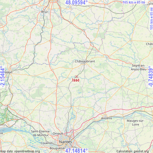
Issé GPS coordinates[2]
47° 37' 27.084" North, 1° 27' 5.472" West
| Map corner | latitude | longitude |
|---|---|---|
| Upper-left | 48.09594°, | -2.15464° |
| Center: | 47.62419°, | -1.45152° |
| Lower-right: | 47.14814°, | -0.74839° |
| Map W x H: | 105.4×105.4 km | = 65.5×65.5mi |
| max Lat: | 51.07786° ⇑46.9% North |
| Issé: | 47.62419° |
| min Lat: | ⇓53.1% South 41.3874° |
| min Long | Issé | max Long |
| -5.08615° | -1.45152° | 9.52242° |
| W 8.1%⇐ | ⇒91.9% E |
Elevation
Elevation of Issé is 38 m = 125 ft, and this is 155.7 m = 511 ft below average elevation for this country.
| Max E: |
2333 m = 7654 ft | 86.7% |
| Avg. | 193.7 m = 635 ft | |
| Issé | 38 m = 125 ft | |
Min E: |
-1 m = -3 ft | 13.3% |
See also: France elevation on elevation.city.
Geographical zone
Issé is located in North temperate zone (between Tropic of Cancer and the Arctic Circle). Distance of this North polar circle is 2105.9 km =1308.5 mi to North.| Distance of | km | miles | from Issé |
|---|---|---|---|
| North Pole | 4711.7 | 2927.7 | to North |
| Arctic Circle | 2105.9 | 1308.5 | to North |
| Tropic Cancer | 2689.4 | 1671.1 | to South |
| Equator | 5295.3 | 3290.3 | to South |


Nearby cities:
15 places around Issé: (largest is in red/bold)
• Abbaretz
9.9 km =6.2 mi,  217°
217°
• Bourg de Joué-sur-Erdre
14.4 km =8.9 mi,  170°
170°
• Châteaubriant
11.8 km =7.3 mi,  28°
28°
• Erbray
10.6 km =6.6 mi,  71°
71°
• Jans
12.2 km =7.6 mi,  267°
267°
• La Meilleraye-de-Bretagne
8.1 km =5 mi,  152°
152°
• Louisfert
5.9 km =3.7 mi,  13°
13°
• Lusanger
12.1 km =7.5 mi,  301°
301°
• Moisdon-la-Rivière
5.9 km =3.7 mi,  92°
92°
• Nozay
14.7 km =9.1 mi,  243°
243°
• Ruffigné
15.1 km =9.4 mi,  347°
347°
• Saint-Aubin-des-Châteaux
11.1 km =6.9 mi, 345°
• Saint-Julien-de-Vouvantes
16 km =9.9 mi,  82°
82°
• Saint-Vincent-des-Landes
4.9 km =3 mi,  317°
317°
• Treffieux
6.4 km =4 mi, 265°
Sources, notices
• [Note1] Compared only with cities in France existing in our database
• [Src1] Map data: © OpenStreetMap contributors (CC-BY-SA)
• [Src2] Other city data from geonames.org with taken over terms of usage.
• [Src3] Geographical zone / Annual Mean Temperature by Robert A. Rohde @ Wikipedia
