La Grande-Paroisse geodata
La Grande-Paroisse (Île-de-France) is a populated place; located in France in Europe/Paris (GMT+2) time zone. With population of 2,474 people, there are 3927 cities with bigger population in this country. Compared to other cities in France, 66.1% of cities are located further ↓South; 56.4% of cities are located further ←West and 55.6% of cities have higher elevation than La Grande-Paroisse. Note1
Administrative division(s):
- Level 1: Île-de-France
- Level 2: Seine-et-Marne
- Level 3: Arrondissement de Provins
- Level 4: La Grande-Paroisse


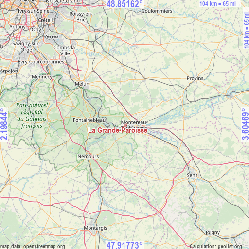
La Grande-Paroisse GPS coordinates[2]
48° 23' 12.552" North, 2° 54' 5.652" East
| Map corner | latitude | longitude |
|---|---|---|
| Upper-left | 48.85162°, | 2.19844° |
| Center: | 48.38682°, | 2.90157° |
| Lower-right: | 47.91773°, | 3.60469° |
| Map W x H: | 103.8×103.8 km | = 64.5×64.5mi |
| max Lat: | 51.07786° ⇑33.9% North |
| La Grande-Paroisse: | 48.38682° |
| min Lat: | ⇓66.1% South 41.3874° |
| min Long | La Grande-Paroi | max Long |
| -5.08615° | 2.90157° | 9.52242° |
| W 56.4%⇐ | ⇒43.6% E |
Elevation
Elevation of La Grande-Paroisse is 115 m = 377 ft, and this is 78.7 m = 258 ft below average elevation for this country.
| Max E: |
2333 m = 7654 ft | 55.6% |
| Avg. | 193.7 m = 635 ft | |
| La Grande-Paroisse | 115 m = 377 ft | |
Min E: |
-1 m = -3 ft | 44.4% |
See also: France elevation on elevation.city.
Geographical zone
La Grande-Paroisse is located in North temperate zone (between Tropic of Cancer and the Arctic Circle). Distance of this North polar circle is 2021.1 km =1255.9 mi to North.| Distance of | km | miles | from La Grande-Paroisse |
|---|---|---|---|
| North Pole | 4627 | 2875.1 | to North |
| Arctic Circle | 2021.1 | 1255.9 | to North |
| Tropic Cancer | 2774.2 | 1723.8 | to South |
| Equator | 5380.1 | 3343 | to South |


Nearby cities:
15 places around La Grande-Paroisse: (largest is in red/bold)
• Cannes-Écluse
6.9 km =4.3 mi,  112°
112°
• Champagne-sur-Seine
7.8 km =4.8 mi,  279°
279°
• Esmans
7.1 km =4.4 mi,  129°
129°
• Montereau-Fault-Yonne
3.6 km =2.2 mi,  96°
96°
• Moret-sur-Loing
6.4 km =4 mi,  255°
255°
• Noisy-Rudignon
6.1 km =3.8 mi,  159°
159°
• Saint-Germain-Laval
7.2 km =4.5 mi,  78°
78°
• Saint-Mammès
6.3 km =3.9 mi,  267°
267°
• Valence-en-Brie
6.3 km =3.9 mi,  352°
352°
• Varennes-sur-Seine
2.4 km =1.5 mi, 130°
• Veneux-les-Sablons
7.9 km =4.9 mi, 263°
• Vernou-la-Celle-sur-Seine
4 km =2.5 mi, 271°
• Ville-Saint-Jacques
4.9 km =3 mi,  182°
182°
• Villecerf
7.7 km =4.8 mi,  211°
211°
• Écuelles
6.7 km =4.2 mi,  239°
239°
Sources, notices
• [Note1] Compared only with cities in France existing in our database
• [Src1] Map data: © OpenStreetMap contributors (CC-BY-SA)
• [Src2] Other city data from geonames.org with taken over terms of usage.
• [Src3] Geographical zone / Annual Mean Temperature by Robert A. Rohde @ Wikipedia
