La Goutelle geodata
La Goutelle (Auvergne-Rhône-Alpes) is a populated place; located in France in Europe/Paris (GMT+2) time zone. With population of 612 people, there are 13126 cities with bigger population in this country. Compared to other cities in France, 68.6% of cities are located further ↑North; 54.3% of cities are located further ←West and 97.6% of cities have lower elevation than La Goutelle. Note1
Administrative division(s):
- Level 1: Auvergne-Rhône-Alpes
- Level 2: Département du Puy-de-Dôme
- Level 3: Arrondissement de Riom
- Level 4: La Goutelle


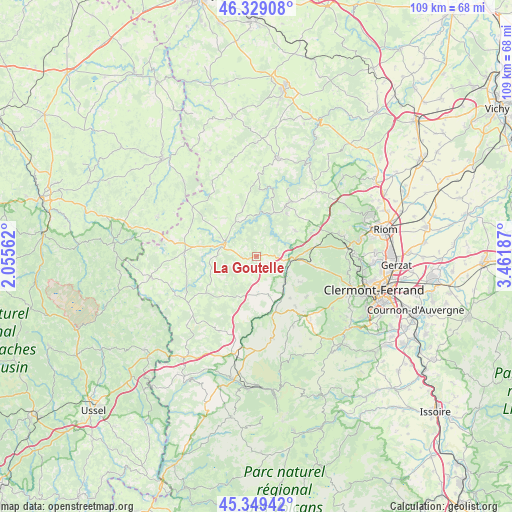
La Goutelle GPS coordinates[2]
45° 50' 29.076" North, 2° 45' 31.5" East
| Map corner | latitude | longitude |
|---|---|---|
| Upper-left | 46.32908°, | 2.05562° |
| Center: | 45.84141°, | 2.75875° |
| Lower-right: | 45.34942°, | 3.46187° |
| Map W x H: | 108.9×108.9 km | = 67.7×67.7mi |
| max Lat: | 51.07786° ⇑68.6% North |
| La Goutelle: | 45.84141° |
| min Lat: | ⇓31.4% South 41.3874° |
| min Long | La Goutelle | max Long |
| -5.08615° | 2.75875° | 9.52242° |
| W 54.3%⇐ | ⇒45.7% E |
Elevation
Elevation of La Goutelle is 777 m = 2549 ft, and this is 583.3 m = 1914 ft above average elevation for this country.
| Max E: |
2333 m = 7654 ft | 2.4% |
| La Goutelle | 777 m 2549 ft | |
| Avg. | 193.7 m = 635 ft | |
Min E: |
-1 m = -3 ft | 97.6% |
See also: France elevation on elevation.city.
Geographical zone
La Goutelle is located in North temperate zone (between Tropic of Cancer and the Arctic Circle). Distance of this North polar circle is 2304.1 km =1431.7 mi to North.| Distance of | km | miles | from La Goutelle |
|---|---|---|---|
| North Pole | 4910 | 3050.9 | to North |
| Arctic Circle | 2304.1 | 1431.7 | to North |
| Tropic Cancer | 2491.2 | 1548 | to South |
| Equator | 5097.1 | 3167.2 | to South |


Nearby cities:
15 places around La Goutelle: (largest is in red/bold)
• Chanat-la-Mouteyre
19.9 km =12.4 mi,  93°
93°
• Chapdes-Beaufort
9.9 km =6.2 mi,  54°
54°
• Charensat
18.7 km =11.6 mi,  329°
329°
• Gelles
8 km =5 mi,  177°
177°
• Les Ancizes
10.2 km =6.3 mi,  24°
24°
• Manzat
19.5 km =12.1 mi, 46°
• Mazaye
10 km =6.2 mi,  128°
128°
• Nébouzat
18 km =11.2 mi,  141°
141°
• Olby
13.6 km =8.5 mi, 141°
• Pontaumur
7.2 km =4.5 mi,  294°
294°
• Pontgibaud
7.2 km =4.5 mi,  97°
97°
• Rochefort-Montagne
17.8 km =11.1 mi,  168°
168°
• Saint-Georges-de-Mons
12.5 km =7.8 mi,  29°
29°
• Saint-Ours
10.3 km =6.4 mi,  84°
84°
• Saint-Priest-des-Champs
16.8 km =10.4 mi,  1°
1°
Sources, notices
• [Note1] Compared only with cities in France existing in our database
• [Src1] Map data: © OpenStreetMap contributors (CC-BY-SA)
• [Src2] Other city data from geonames.org with taken over terms of usage.
• [Src3] Geographical zone / Annual Mean Temperature by Robert A. Rohde @ Wikipedia
