Gelles geodata
Gelles (Auvergne-Rhône-Alpes) is a populated place; located in France in Europe/Paris (GMT+2) time zone. With population of 1,032 people, there are 8599 cities with bigger population in this country. Compared to other cities in France, 69.7% of cities are located further ↑North; 54.4% of cities are located further ←West and 98.3% of cities have lower elevation than Gelles. Note1
Administrative division(s):
- Level 1: Auvergne-Rhône-Alpes
- Level 2: Département du Puy-de-Dôme
- Level 3: Issoire
- Level 4: Gelles


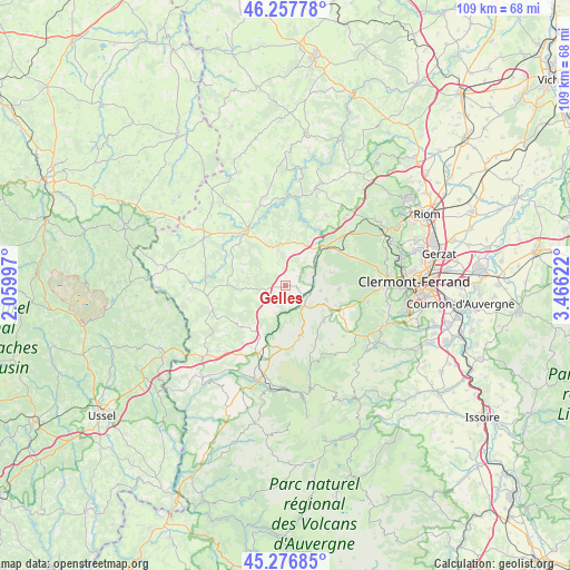
Gelles GPS coordinates[2]
45° 46' 10.092" North, 2° 45' 47.124" East
| Map corner | latitude | longitude |
|---|---|---|
| Upper-left | 46.25778°, | 2.05997° |
| Center: | 45.76947°, | 2.76309° |
| Lower-right: | 45.27685°, | 3.46622° |
| Map W x H: | 109.1×109.1 km | = 67.8×67.8mi |
| max Lat: | 51.07786° ⇑69.7% North |
| Gelles: | 45.76947° |
| min Lat: | ⇓30.3% South 41.3874° |
| min Long | Gelles | max Long |
| -5.08615° | 2.76309° | 9.52242° |
| W 54.4%⇐ | ⇒45.6% E |
Elevation
Elevation of Gelles is 858 m = 2815 ft, and this is 664.3 m = 2179 ft above average elevation for this country.
| Max E: |
2333 m = 7654 ft | 1.7% |
| Gelles | 858 m 2815 ft | |
| Avg. | 193.7 m = 635 ft | |
Min E: |
-1 m = -3 ft | 98.3% |
See also: France elevation on elevation.city.
Geographical zone
Gelles is located in North temperate zone (between Tropic of Cancer and the Arctic Circle). Distance of this North polar circle is 2312.1 km =1436.7 mi to North.| Distance of | km | miles | from Gelles |
|---|---|---|---|
| North Pole | 4918 | 3055.9 | to North |
| Arctic Circle | 2312.1 | 1436.7 | to North |
| Tropic Cancer | 2483.2 | 1543 | to South |
| Equator | 5089.1 | 3162.2 | to South |


Nearby cities:
15 places around Gelles: (largest is in red/bold)
• Aydat
20.3 km =12.6 mi,  126°
126°
• Chapdes-Beaufort
15.8 km =9.8 mi,  29°
29°
• La Bourboule
20.2 km =12.6 mi,  185°
185°
• La Goutelle
8 km =5 mi,  357°
357°
• Les Ancizes
17.7 km =11 mi,  12°
12°
• Mazaye
7.7 km =4.8 mi,  76°
76°
• Nébouzat
12.5 km =7.8 mi,  118°
118°
• Olby
8.5 km =5.3 mi,  108°
108°
• Orcines
19.4 km =12.1 mi,  85°
85°
• Pontaumur
13 km =8.1 mi,  328°
328°
• Pontgibaud
9.8 km =6.1 mi,  44°
44°
• Rochefort-Montagne
10 km =6.2 mi,  161°
161°
• Saint-Georges-de-Mons
19.8 km =12.3 mi,  17°
17°
• Saint-Ours
13.4 km =8.3 mi,  47°
47°
• Saint-Sauves-d'Auvergne
19.8 km =12.3 mi,  198°
198°
Sources, notices
• [Note1] Compared only with cities in France existing in our database
• [Src1] Map data: © OpenStreetMap contributors (CC-BY-SA)
• [Src2] Other city data from geonames.org with taken over terms of usage.
• [Src3] Geographical zone / Annual Mean Temperature by Robert A. Rohde @ Wikipedia
