La Ferté-Chevresis geodata
La Ferté-Chevresis (Hauts-de-France) is a populated place; located in France in Europe/Paris (GMT+2) time zone. With population of 588 people, there are 13513 cities with bigger population in this country. Compared to other cities in France, 91.8% of cities are located further ↓South; 64.7% of cities are located further ←West and 77% of cities have higher elevation than La Ferté-Chevresis. Note1
Administrative division(s):
- Level 1: Hauts-de-France
- Level 2: Département de l'Aisne
- Level 3: Arrondissement de Saint-Quentin
- Level 4: La Ferté-Chevresis


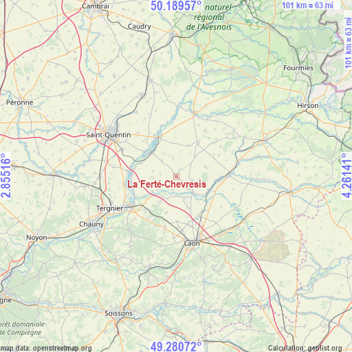
La Ferté-Chevresis GPS coordinates[2]
49° 44' 14.172" North, 3° 33' 29.844" East
| Map corner | latitude | longitude |
|---|---|---|
| Upper-left | 50.18957°, | 2.85516° |
| Center: | 49.73727°, | 3.55829° |
| Lower-right: | 49.28072°, | 4.26141° |
| Map W x H: | 101.1×101.1 km | = 62.8×62.8mi |
| max Lat: | 51.07786° ⇑8.2% North |
| La Ferté-Chevresis: | 49.73727° |
| min Lat: | ⇓91.8% South 41.3874° |
| min Long | La Ferté-Chevr | max Long |
| -5.08615° | 3.55829° | 9.52242° |
| W 64.7%⇐ | ⇒35.3% E |
Elevation
Elevation of La Ferté-Chevresis is 62 m = 203 ft, and this is 131.7 m = 432 ft below average elevation for this country.
| Max E: |
2333 m = 7654 ft | 77% |
| Avg. | 193.7 m = 635 ft | |
| La Ferté-Chevresis | 62 m = 203 ft | |
Min E: |
-1 m = -3 ft | 23% |
See also: France elevation on elevation.city.
Geographical zone
La Ferté-Chevresis is located in North temperate zone (between Tropic of Cancer and the Arctic Circle). Distance of this North polar circle is 1870.9 km =1162.5 mi to North.| Distance of | km | miles | from La Ferté-Chevresis |
|---|---|---|---|
| North Pole | 4476.8 | 2781.8 | to North |
| Arctic Circle | 1870.9 | 1162.5 | to North |
| Tropic Cancer | 2924.3 | 1817.1 | to South |
| Equator | 5530.3 | 3436.4 | to South |


Nearby cities:
15 places around La Ferté-Chevresis: (largest is in red/bold)
• Achery
13 km =8.1 mi,  248°
248°
• Aulnois-sous-Laon
14.1 km =8.8 mi,  166°
166°
• Barenton-Bugny
13.4 km =8.3 mi,  149°
149°
• Chéry-lès-Pouilly
9.5 km =5.9 mi,  159°
159°
• Couvron-et-Aumencourt
10.7 km =6.6 mi,  195°
195°
• Crécy-sur-Serre
6.6 km =4.1 mi,  133°
133°
• Mézières-sur-Oise
12.3 km =7.6 mi,  294°
294°
• Nouvion-et-Catillon
6.6 km =4.1 mi,  234°
234°
• Origny-Sainte-Benoite
11.5 km =7.1 mi,  338°
338°
• Pouilly-sur-Serre
6.6 km =4.1 mi, 160°
• Ribemont
9.6 km =6 mi,  312°
312°
• Sissy
11.8 km =7.3 mi, 307°
• Séry-lès-Mézières
10.6 km =6.6 mi, 292°
• Thenelles
12.2 km =7.6 mi,  327°
327°
• Vivaise
12.9 km =8 mi,  179°
179°
Sources, notices
• [Note1] Compared only with cities in France existing in our database
• [Src1] Map data: © OpenStreetMap contributors (CC-BY-SA)
• [Src2] Other city data from geonames.org with taken over terms of usage.
• [Src3] Geographical zone / Annual Mean Temperature by Robert A. Rohde @ Wikipedia
