Barenton-Bugny geodata
Barenton-Bugny (Hauts-de-France) is a populated place; located in France in Europe/Paris (GMT+2) time zone. With population of 539 people, there are 14413 cities with bigger population in this country. Compared to other cities in France, 90.9% of cities are located further ↓South; 65.4% of cities are located further ←West and 73.1% of cities have higher elevation than Barenton-Bugny. Note1
Administrative division(s):
- Level 1: Hauts-de-France
- Level 2: Département de l'Aisne
- Level 3: Arrondissement de Laon
- Level 4: Barenton-Bugny


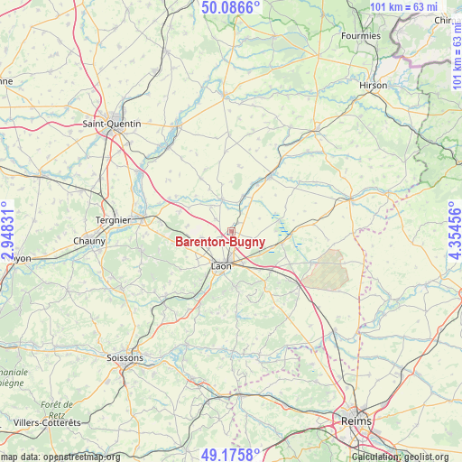
Barenton-Bugny GPS coordinates[2]
49° 37' 59.988" North, 3° 39' 5.148" East
| Map corner | latitude | longitude |
|---|---|---|
| Upper-left | 50.0866°, | 2.94831° |
| Center: | 49.63333°, | 3.65143° |
| Lower-right: | 49.1758°, | 4.35456° |
| Map W x H: | 101.3×101.3 km | = 62.9×62.9mi |
| max Lat: | 51.07786° ⇑9.1% North |
| Barenton-Bugny: | 49.63333° |
| min Lat: | ⇓90.9% South 41.3874° |
| min Long | Barenton-Bugny | max Long |
| -5.08615° | 3.65143° | 9.52242° |
| W 65.4%⇐ | ⇒34.6% E |
Elevation
Elevation of Barenton-Bugny is 71 m = 233 ft, and this is 122.7 m = 403 ft below average elevation for this country.
| Max E: |
2333 m = 7654 ft | 73.1% |
| Avg. | 193.7 m = 635 ft | |
| Barenton-Bugny | 71 m = 233 ft | |
Min E: |
-1 m = -3 ft | 26.9% |
See also: France elevation on elevation.city.
Geographical zone
Barenton-Bugny is located in North temperate zone (between Tropic of Cancer and the Arctic Circle). Distance of this North polar circle is 1882.5 km =1169.7 mi to North.| Distance of | km | miles | from Barenton-Bugny |
|---|---|---|---|
| North Pole | 4488.4 | 2789 | to North |
| Arctic Circle | 1882.5 | 1169.7 | to North |
| Tropic Cancer | 2912.8 | 1809.9 | to South |
| Equator | 5518.7 | 3429.2 | to South |


Nearby cities:
15 places around Barenton-Bugny: (largest is in red/bold)
• Athies-sous-Laon
7 km =4.3 mi,  160°
160°
• Aulnois-sous-Laon
3.9 km =2.4 mi,  237°
237°
• Bruyères-et-Montbérault
12 km =7.5 mi,  175°
175°
• Chambry
4.6 km =2.9 mi,  174°
174°
• Chivy-lès-Étouvelles
12.7 km =7.9 mi,  204°
204°
• Chéry-lès-Pouilly
4.3 km =2.7 mi,  308°
308°
• Coucy-lès-Eppes
12.4 km =7.7 mi,  135°
135°
• Couvron-et-Aumencourt
9.7 km =6 mi,  277°
277°
• Crécy-sur-Serre
7.2 km =4.5 mi,  344°
344°
• Crépy
10.4 km =6.5 mi,  249°
249°
• Gizy
9.6 km =6 mi,  112°
112°
• Laon
8 km =5 mi,  192°
192°
• Liesse-Notre-Dame
10.9 km =6.8 mi,  99°
99°
• Pouilly-sur-Serre
7 km =4.3 mi,  320°
320°
• Vivaise
6.6 km =4.1 mi,  257°
257°
Sources, notices
• [Note1] Compared only with cities in France existing in our database
• [Src1] Map data: © OpenStreetMap contributors (CC-BY-SA)
• [Src2] Other city data from geonames.org with taken over terms of usage.
• [Src3] Geographical zone / Annual Mean Temperature by Robert A. Rohde @ Wikipedia
