Origny-Sainte-Benoite geodata
Origny-Sainte-Benoite (Hauts-de-France) is a populated place; located in France in Europe/Paris (GMT+2) time zone. With population of 1,780 people, there are 5331 cities with bigger population in this country. Compared to other cities in France, 92.5% of cities are located further ↓South; 64.2% of cities are located further ←West and 58.7% of cities have higher elevation than Origny-Sainte-Benoite. Note1
Administrative division(s):
- Level 1: Hauts-de-France
- Level 2: Département de l'Aisne
- Level 3: Arrondissement de Saint-Quentin
- Level 4: Origny-Sainte-Benoite
Current local time in Origny-Sainte-Benoite:
05:52 AM, WednesdayDifference from your time zone: hours


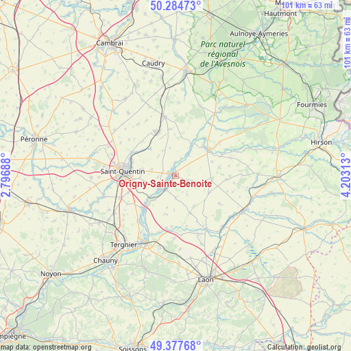
Origny-Sainte-Benoite GPS coordinates[2]
49° 49' 59.988" North, 3° 30' 0" East
| Map corner | latitude | longitude |
|---|---|---|
| Upper-left | 50.28473°, | 2.79688° |
| Center: | 49.83333°, | 3.5° |
| Lower-right: | 49.37768°, | 4.20313° |
| Map W x H: | 100.9×100.9 km | = 62.7×62.7mi |
| max Lat: | 51.07786° ⇑7.5% North |
| Origny-Sainte-Benoite: | 49.83333° |
| min Lat: | ⇓92.5% South 41.3874° |
| min Long | Origny-Sainte-B | max Long |
| -5.08615° | 3.5° | 9.52242° |
| W 64.2%⇐ | ⇒35.8% E |
Elevation
Elevation of Origny-Sainte-Benoite is 106 m = 348 ft, and this is 87.7 m = 288 ft below average elevation for this country.
| Max E: |
2333 m = 7654 ft | 58.7% |
| Avg. | 193.7 m = 635 ft | |
| Origny-Sainte-Benoite | 106 m = 348 ft | |
Min E: |
-1 m = -3 ft | 41.3% |
See also: France elevation on elevation.city.
Geographical zone
Origny-Sainte-Benoite is located in North temperate zone (between Tropic of Cancer and the Arctic Circle). Distance of this North polar circle is 1860.2 km =1155.9 mi to North.| Distance of | km | miles | from Origny-Sainte-Benoite |
|---|---|---|---|
| North Pole | 4466.1 | 2775.1 | to North |
| Arctic Circle | 1860.2 | 1155.9 | to North |
| Tropic Cancer | 2935 | 1823.7 | to South |
| Equator | 5540.9 | 3443 | to South |


Nearby cities:
15 places around Origny-Sainte-Benoite: (largest is in red/bold)
• Fonsomme
10.3 km =6.4 mi,  315°
315°
• Guise
11.8 km =7.3 mi,  50°
50°
• Homblières
9.9 km =6.2 mi,  281°
281°
• Itancourt
11.6 km =7.2 mi,  255°
255°
• La Ferté-Chevresis
11.5 km =7.1 mi,  158°
158°
• Morcourt
13.5 km =8.4 mi,  289°
289°
• Mézières-sur-Oise
8.9 km =5.5 mi,  231°
231°
• Neuville-Saint-Amand
11.9 km =7.4 mi,  266°
266°
• Ribemont
5.1 km =3.2 mi,  214°
214°
• Seboncourt
13.4 km =8.3 mi,  352°
352°
• Sissy
6.3 km =3.9 mi,  236°
236°
• Séry-lès-Mézières
8.7 km =5.4 mi,  220°
220°
• Thenelles
2.4 km =1.5 mi, 261°
• Vadencourt
12.1 km =7.5 mi,  23°
23°
• Étaves-et-Bocquiaux
12.2 km =7.6 mi, 345°
Sources, notices
• [Note1] Compared only with cities in France existing in our database
• [Src1] Map data: © OpenStreetMap contributors (CC-BY-SA)
• [Src2] Other city data from geonames.org with taken over terms of usage.
• [Src3] Geographical zone / Annual Mean Temperature by Robert A. Rohde @ Wikipedia
