Lachelle geodata
Lachelle (Hauts-de-France) is a populated place; located in France in Europe/Paris (GMT+2) time zone. With population of 596 people, there are 13387 cities with bigger population in this country. Compared to other cities in France, 88.5% of cities are located further ↓South; 54% of cities are located further ←West and 74.1% of cities have higher elevation than Lachelle. Note1
Administrative division(s):
- Level 1: Hauts-de-France
- Level 2: Département de l'Oise
- Level 3: Arrondissement de Compiègne
- Level 4: Lachelle


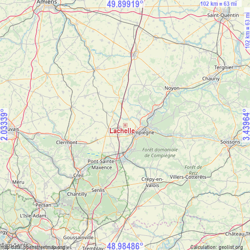
Lachelle GPS coordinates[2]
49° 26' 38.976" North, 2° 44' 11.436" East
| Map corner | latitude | longitude |
|---|---|---|
| Upper-left | 49.89919°, | 2.03339° |
| Center: | 49.44416°, | 2.73651° |
| Lower-right: | 48.98486°, | 3.43964° |
| Map W x H: | 101.7×101.7 km | = 63.2×63.2mi |
| max Lat: | 51.07786° ⇑11.5% North |
| Lachelle: | 49.44416° |
| min Lat: | ⇓88.5% South 41.3874° |
| min Long | Lachelle | max Long |
| -5.08615° | 2.73651° | 9.52242° |
| W 54%⇐ | ⇒46% E |
Elevation
Elevation of Lachelle is 69 m = 226 ft, and this is 124.7 m = 409 ft below average elevation for this country.
| Max E: |
2333 m = 7654 ft | 74.1% |
| Avg. | 193.7 m = 635 ft | |
| Lachelle | 69 m = 226 ft | |
Min E: |
-1 m = -3 ft | 25.9% |
See also: France elevation on elevation.city.
Geographical zone
Lachelle is located in North temperate zone (between Tropic of Cancer and the Arctic Circle). Distance of this North polar circle is 1903.5 km =1182.8 mi to North.| Distance of | km | miles | from Lachelle |
|---|---|---|---|
| North Pole | 4509.4 | 2802 | to North |
| Arctic Circle | 1903.5 | 1182.8 | to North |
| Tropic Cancer | 2891.8 | 1796.9 | to South |
| Equator | 5497.7 | 3416.1 | to South |


Nearby cities:
15 places around Lachelle: (largest is in red/bold)
• Arsy
5.9 km =3.7 mi,  214°
214°
• Canly
6.8 km =4.2 mi,  197°
197°
• Compiègne
7.1 km =4.4 mi,  114°
114°
• Coudun
5.8 km =3.6 mi,  70°
70°
• Francières
4.2 km =2.6 mi,  277°
277°
• Giraumont
6.8 km =4.2 mi,  63°
63°
• Gournay-sur-Aronde
7 km =4.3 mi,  320°
320°
• Jaux
6.6 km =4.1 mi,  152°
152°
• Jonquières
6.1 km =3.8 mi,  183°
183°
• Margny-lès-Compiègne
6.2 km =3.9 mi, 109°
• Monchy-Humières
3.1 km =1.9 mi,  17°
17°
• Moyvillers
7 km =4.3 mi,  242°
242°
• Remy
1.9 km =1.2 mi,  229°
229°
• Venette
5.7 km =3.5 mi,  122°
122°
• Villers-sur-Coudun
6.6 km =4.1 mi,  48°
48°
Sources, notices
• [Note1] Compared only with cities in France existing in our database
• [Src1] Map data: © OpenStreetMap contributors (CC-BY-SA)
• [Src2] Other city data from geonames.org with taken over terms of usage.
• [Src3] Geographical zone / Annual Mean Temperature by Robert A. Rohde @ Wikipedia
