Gournay-sur-Aronde geodata
Gournay-sur-Aronde (Hauts-de-France) is a populated place; located in France in Europe/Paris (GMT+2) time zone. With population of 615 people, there are 13071 cities with bigger population in this country. Compared to other cities in France, 89.1% of cities are located further ↓South; 53.1% of cities are located further ←West and 73.6% of cities have higher elevation than Gournay-sur-Aronde. Note1
Administrative division(s):
- Level 1: Hauts-de-France
- Level 2: Département de l'Oise
- Level 3: Arrondissement de Compiègne
- Level 4: Gournay-sur-Aronde


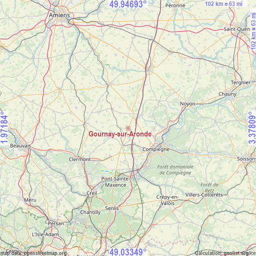
Gournay-sur-Aronde GPS coordinates[2]
49° 29' 32.424" North, 2° 40' 29.856" East
| Map corner | latitude | longitude |
|---|---|---|
| Upper-left | 49.94693°, | 1.97184° |
| Center: | 49.49234°, | 2.67496° |
| Lower-right: | 49.03349°, | 3.37809° |
| Map W x H: | 101.6×101.6 km | = 63.1×63.1mi |
| max Lat: | 51.07786° ⇑10.9% North |
| Gournay-sur-Aronde: | 49.49234° |
| min Lat: | ⇓89.1% South 41.3874° |
| min Long | Gournay-sur-Aro | max Long |
| -5.08615° | 2.67496° | 9.52242° |
| W 53.1%⇐ | ⇒46.9% E |
Elevation
Elevation of Gournay-sur-Aronde is 70 m = 230 ft, and this is 123.7 m = 406 ft below average elevation for this country.
| Max E: |
2333 m = 7654 ft | 73.6% |
| Avg. | 193.7 m = 635 ft | |
| Gournay-sur-Aronde | 70 m = 230 ft | |
Min E: |
-1 m = -3 ft | 26.4% |
See also: France elevation on elevation.city.
Geographical zone
Gournay-sur-Aronde is located in North temperate zone (between Tropic of Cancer and the Arctic Circle). Distance of this North polar circle is 1898.1 km =1179.4 mi to North.| Distance of | km | miles | from Gournay-sur-Aronde |
|---|---|---|---|
| North Pole | 4504 | 2798.7 | to North |
| Arctic Circle | 1898.1 | 1179.4 | to North |
| Tropic Cancer | 2897.1 | 1800.2 | to South |
| Equator | 5503 | 3419.4 | to South |


Nearby cities:
15 places around Gournay-sur-Aronde: (largest is in red/bold)
• Cuvilly
7 km =4.3 mi,  11°
11°
• Estrées-Saint-Denis
7.7 km =4.8 mi,  197°
197°
• Francières
4.9 km =3 mi,  176°
176°
• La Neuville-Roy
6.7 km =4.2 mi,  261°
261°
• Lachelle
7 km =4.3 mi,  140°
140°
• Mareuil-la-Motte
10.1 km =6.3 mi,  54°
54°
• Monchy-Humières
5.9 km =3.7 mi,  114°
114°
• Moyenneville
2.9 km =1.8 mi,  265°
265°
• Moyvillers
8.8 km =5.5 mi,  191°
191°
• Méry-la-Bataille
6.9 km =4.3 mi,  330°
330°
• Orvillers-Sorel
9.8 km =6.1 mi, 14°
• Remy
7.2 km =4.5 mi,  155°
155°
• Ressons-sur-Matz
7.2 km =4.5 mi,  44°
44°
• Tricot
9.9 km =6.2 mi,  320°
320°
• Villers-sur-Coudun
9.4 km =5.8 mi,  96°
96°
Sources, notices
• [Note1] Compared only with cities in France existing in our database
• [Src1] Map data: © OpenStreetMap contributors (CC-BY-SA)
• [Src2] Other city data from geonames.org with taken over terms of usage.
• [Src3] Geographical zone / Annual Mean Temperature by Robert A. Rohde @ Wikipedia
