La Chapelle-Saint-Mesmin geodata
La Chapelle-Saint-Mesmin (Centre) is a populated place; located in France in Europe/Paris (GMT+2) time zone. With population of 9,532 people, there are 997 cities with bigger population in this country. Compared to other cities in France, 57.3% of cities are located further ↓South; 59% of cities are located further →East and 60% of cities have higher elevation than La Chapelle-Saint-Mesmin. Note1
Administrative division(s):
- Level 1: Centre
- Level 2: Loiret
- Level 3: Arrondissement d’Orléans
- Level 4: La Chapelle-Saint-Mesmin
Current local time in La Chapelle-Saint-Mesmin:
07:04 AM, SaturdayDifference from your time zone: hours


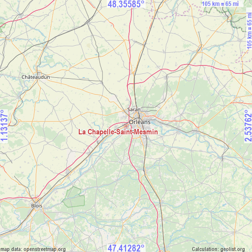
La Chapelle-Saint-Mesmin GPS coordinates[2]
47° 53' 11.328" North, 1° 50' 4.2" East
| Map corner | latitude | longitude |
|---|---|---|
| Upper-left | 48.35585°, | 1.13137° |
| Center: | 47.88648°, | 1.8345° |
| Lower-right: | 47.41282°, | 2.53762° |
| Map W x H: | 104.9×104.9 km | = 65.2×65.2mi |
| max Lat: | 51.07786° ⇑42.7% North |
| La Chapelle-Saint-Mesmin: | 47.88648° |
| min Lat: | ⇓57.3% South 41.3874° |
| min Long | La Chapelle-Sai | max Long |
| -5.08615° | 1.8345° | 9.52242° |
| W 41%⇐ | ⇒59% E |
Elevation
Elevation of La Chapelle-Saint-Mesmin is 102 m = 335 ft, and this is 91.7 m = 301 ft below average elevation for this country.
| Max E: |
2333 m = 7654 ft | 60% |
| Avg. | 193.7 m = 635 ft | |
| La Chapelle-Saint-Mesmin | 102 m = 335 ft | |
Min E: |
-1 m = -3 ft | 40% |
See also: France elevation on elevation.city.
Geographical zone
La Chapelle-Saint-Mesmin is located in North temperate zone (between Tropic of Cancer and the Arctic Circle). Distance of this North polar circle is 2076.7 km =1290.4 mi to North.| Distance of | km | miles | from La Chapelle-Saint-Mesmin |
|---|---|---|---|
| North Pole | 4682.6 | 2909.6 | to North |
| Arctic Circle | 2076.7 | 1290.4 | to North |
| Tropic Cancer | 2718.6 | 1689.3 | to South |
| Equator | 5324.5 | 3308.5 | to South |


Nearby cities:
15 places around La Chapelle-Saint-Mesmin: (largest is in red/bold)
• Chaingy
4.8 km =3 mi,  265°
265°
• Cléry-Saint-André
9.5 km =5.9 mi,  221°
221°
• Fleury-les-Aubrais
8.1 km =5 mi,  50°
50°
• Ingré
3.8 km =2.4 mi,  352°
352°
• Mareau-aux-Prés
4.4 km =2.7 mi,  240°
240°
• Mézières-lez-Cléry
8.1 km =5 mi,  196°
196°
• Olivet
5.5 km =3.4 mi,  119°
119°
• Orléans
5.5 km =3.4 mi,  70°
70°
• Ormes
6.2 km =3.9 mi, 348°
• Saint-Ay
6.9 km =4.3 mi, 243°
• Saint-Hilaire-Saint-Mesmin
2.3 km =1.4 mi,  181°
181°
• Saint-Jean-de-la-Ruelle
3.6 km =2.2 mi,  39°
39°
• Saint-Jean-le-Blanc
6.1 km =3.8 mi,  82°
82°
• Saint-Pryvé-Saint-Mesmin
2.7 km =1.7 mi,  101°
101°
• Saran
7.7 km =4.8 mi,  23°
23°
Sources, notices
• [Note1] Compared only with cities in France existing in our database
• [Src1] Map data: © OpenStreetMap contributors (CC-BY-SA)
• [Src2] Other city data from geonames.org with taken over terms of usage.
• [Src3] Geographical zone / Annual Mean Temperature by Robert A. Rohde @ Wikipedia
