Ingré geodata
Ingré (Centre) is a populated place; located in France in Europe/Paris (GMT+2) time zone. With population of 8,001 people, there are 1212 cities with bigger population in this country. Compared to other cities in France, 57.9% of cities are located further ↓South; 59.1% of cities are located further →East and 54.1% of cities have higher elevation than Ingré. Note1
Administrative division(s):
- Level 1: Centre
- Level 2: Loiret
- Level 3: Arrondissement d’Orléans
- Level 4: Ingré


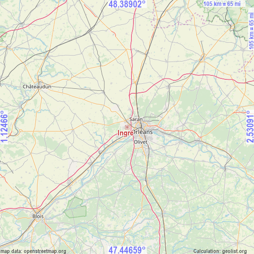
Ingré GPS coordinates[2]
47° 55' 11.82" North, 1° 49' 40.008" East
| Map corner | latitude | longitude |
|---|---|---|
| Upper-left | 48.38902°, | 1.12466° |
| Center: | 47.91995°, | 1.82778° |
| Lower-right: | 47.44659°, | 2.53091° |
| Map W x H: | 104.8×104.8 km | = 65.1×65.1mi |
| max Lat: | 51.07786° ⇑42.1% North |
| Ingré: | 47.91995° |
| min Lat: | ⇓57.9% South 41.3874° |
| min Long | Ingré | max Long |
| -5.08615° | 1.82778° | 9.52242° |
| W 40.9%⇐ | ⇒59.1% E |
Elevation
Elevation of Ingré is 119 m = 390 ft, and this is 74.7 m = 245 ft below average elevation for this country.
| Max E: |
2333 m = 7654 ft | 54.1% |
| Avg. | 193.7 m = 635 ft | |
| Ingré | 119 m = 390 ft | |
Min E: |
-1 m = -3 ft | 45.9% |
See also: France elevation on elevation.city.
Geographical zone
Ingré is located in North temperate zone (between Tropic of Cancer and the Arctic Circle). Distance of this North polar circle is 2073 km =1288.1 mi to North.| Distance of | km | miles | from Ingré |
|---|---|---|---|
| North Pole | 4678.9 | 2907.3 | to North |
| Arctic Circle | 2073 | 1288.1 | to North |
| Tropic Cancer | 2722.3 | 1691.6 | to South |
| Equator | 5328.2 | 3310.8 | to South |


Nearby cities:
15 places around Ingré: (largest is in red/bold)
• Boulay-les-Barres
7.9 km =4.9 mi,  334°
334°
• Cercottes
8.5 km =5.3 mi,  29°
29°
• Chaingy
5.9 km =3.7 mi,  226°
226°
• Fleury-les-Aubrais
6.9 km =4.3 mi,  77°
77°
• Gidy
7.3 km =4.5 mi,  6°
6°
• La Chapelle-Saint-Mesmin
3.8 km =2.4 mi,  172°
172°
• Mareau-aux-Prés
6.8 km =4.2 mi,  209°
209°
• Olivet
8.3 km =5.2 mi,  140°
140°
• Orléans
6 km =3.7 mi,  108°
108°
• Ormes
2.5 km =1.6 mi,  343°
343°
• Saint-Hilaire-Saint-Mesmin
6 km =3.7 mi,  175°
175°
• Saint-Jean-de-la-Ruelle
2.9 km =1.8 mi, 109°
• Saint-Jean-le-Blanc
7.2 km =4.5 mi, 114°
• Saint-Pryvé-Saint-Mesmin
5.3 km =3.3 mi, 143°
• Saran
4.9 km =3 mi,  46°
46°
Sources, notices
• [Note1] Compared only with cities in France existing in our database
• [Src1] Map data: © OpenStreetMap contributors (CC-BY-SA)
• [Src2] Other city data from geonames.org with taken over terms of usage.
• [Src3] Geographical zone / Annual Mean Temperature by Robert A. Rohde @ Wikipedia
