La Bâtie-Montgascon geodata
La Bâtie-Montgascon (Auvergne-Rhône-Alpes) is a populated place; located in France in Europe/Paris (GMT+2) time zone. With population of 1,556 people, there are 5990 cities with bigger population in this country. Compared to other cities in France, 72.9% of cities are located further ↑North; 83.1% of cities are located further ←West and 86.6% of cities have lower elevation than La Bâtie-Montgascon. Note1
Administrative division(s):
- Level 1: Auvergne-Rhône-Alpes
- Level 2: Département de l'Isère
- Level 3: Arrondissement de La Tour-du-Pin
- Level 4: La Bâtie-Montgascon


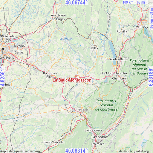
La Bâtie-Montgascon GPS coordinates[2]
45° 34' 38.82" North, 5° 31' 43.428" East
| Map corner | latitude | longitude |
|---|---|---|
| Upper-left | 46.06744°, | 4.82561° |
| Center: | 45.57745°, | 5.52873° |
| Lower-right: | 45.08314°, | 6.23186° |
| Map W x H: | 109.4×109.4 km | = 68×68mi |
| max Lat: | 51.07786° ⇑72.9% North |
| La Bâtie-Montgascon: | 45.57745° |
| min Lat: | ⇓27.1% South 41.3874° |
| min Long | La Bâtie-Montg | max Long |
| -5.08615° | 5.52873° | 9.52242° |
| W 83.1%⇐ | ⇒16.9% E |
Elevation
Elevation of La Bâtie-Montgascon is 368 m = 1207 ft, and this is 174.3 m = 572 ft above average elevation for this country.
| Max E: |
2333 m = 7654 ft | 13.4% |
| La Bâtie-Montgascon | 368 m 1207 ft | |
| Avg. | 193.7 m = 635 ft | |
Min E: |
-1 m = -3 ft | 86.6% |
See also: France elevation on elevation.city.
Geographical zone
La Bâtie-Montgascon is located in North temperate zone (between Tropic of Cancer and the Arctic Circle). Distance of this North polar circle is 2333.4 km =1449.9 mi to North.| Distance of | km | miles | from La Bâtie-Montgascon |
|---|---|---|---|
| North Pole | 4939.3 | 3069.1 | to North |
| Arctic Circle | 2333.4 | 1449.9 | to North |
| Tropic Cancer | 2461.8 | 1529.7 | to South |
| Equator | 5067.7 | 3148.9 | to South |


Nearby cities:
15 places around La Bâtie-Montgascon: (largest is in red/bold)
• Aoste
6.4 km =4 mi,  72°
72°
• Charancieu
6.9 km =4.3 mi,  140°
140°
• Chimilin
5.2 km =3.2 mi,  93°
93°
• Corbelin
3.5 km =2.2 mi,  18°
18°
• Dolomieu
4.6 km =2.9 mi,  312°
312°
• Faverges-de-la-Tour
1.6 km =1 mi,  338°
338°
• Fitilieu
4.2 km =2.6 mi, 142°
• La Chapelle-de-la-Tour
5.1 km =3.2 mi,  279°
279°
• La Tour-du-Pin
6.7 km =4.2 mi,  258°
258°
• Le Passage
5 km =3.1 mi,  194°
194°
• Les Abrets
5.4 km =3.4 mi,  132°
132°
• Saint-André-le-Gaz
3.6 km =2.2 mi,  179°
179°
• Saint-Clair-de-la-Tour
4 km =2.5 mi, 263°
• Saint-Didier-de-la-Tour
4.4 km =2.7 mi,  239°
239°
• Saint-Ondras
6.8 km =4.2 mi,  167°
167°
Sources, notices
• [Note1] Compared only with cities in France existing in our database
• [Src1] Map data: © OpenStreetMap contributors (CC-BY-SA)
• [Src2] Other city data from geonames.org with taken over terms of usage.
• [Src3] Geographical zone / Annual Mean Temperature by Robert A. Rohde @ Wikipedia
