Labarthe-Inard geodata
Labarthe-Inard (Occitanie) is a populated place; located in France in Europe/Paris (GMT+2) time zone. With population of 886 people, there are 9774 cities with bigger population in this country. Compared to other cities in France, 97.9% of cities are located further ↑North; 70.2% of cities are located further →East and 83.7% of cities have lower elevation than Labarthe-Inard. Note1
Administrative division(s):
- Level 1: Occitanie
- Level 2: Haute-Garonne
- Level 3: Arrondissement de Saint-Gaudens
- Level 4: Labarthe-Inard


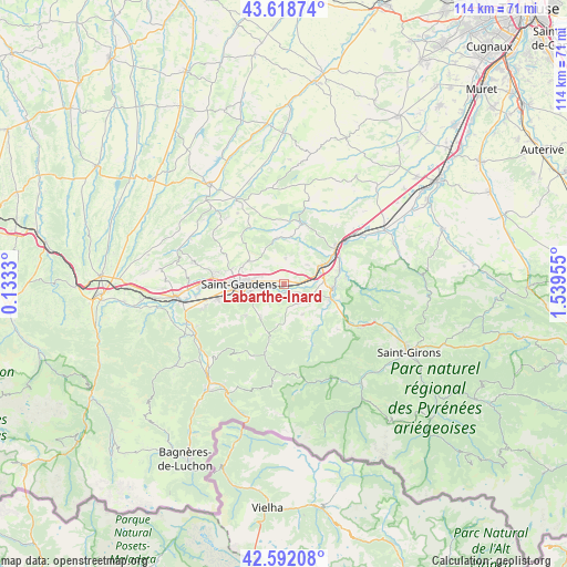
Labarthe-Inard GPS coordinates[2]
43° 6' 27.216" North, 0° 50' 11.112" East
| Map corner | latitude | longitude |
|---|---|---|
| Upper-left | 43.61874°, | 0.1333° |
| Center: | 43.10756°, | 0.83642° |
| Lower-right: | 42.59208°, | 1.53955° |
| Map W x H: | 114.2×114.2 km | = 71×71mi |
| max Lat: | 51.07786° ⇑97.9% North |
| Labarthe-Inard: | 43.10756° |
| min Lat: | ⇓2.1% South 41.3874° |
| min Long | Labarthe-Inard | max Long |
| -5.08615° | 0.83642° | 9.52242° |
| W 29.8%⇐ | ⇒70.2% E |
Elevation
Elevation of Labarthe-Inard is 331 m = 1086 ft, and this is 137.3 m = 450 ft above average elevation for this country.
| Max E: |
2333 m = 7654 ft | 16.3% |
| Labarthe-Inard | 331 m 1086 ft | |
| Avg. | 193.7 m = 635 ft | |
Min E: |
-1 m = -3 ft | 83.7% |
See also: France elevation on elevation.city.
Geographical zone
Labarthe-Inard is located in North temperate zone (between Tropic of Cancer and the Arctic Circle). Distance of this Northern Tropic circle is 2187.2 km =1359.1 mi to South.| Distance of | km | miles | from Labarthe-Inard |
|---|---|---|---|
| North Pole | 5214 | 3239.8 | to North |
| Arctic Circle | 2608.1 | 1620.6 | to North |
| Tropic Cancer | 2187.2 | 1359.1 | to South |
| Equator | 4793.1 | 2978.3 | to South |


Nearby cities:
15 places around Labarthe-Inard: (largest is in red/bold)
• Aspet
10.7 km =6.6 mi,  194°
194°
• Aurignac
12.7 km =7.9 mi,  16°
16°
• Boussens
13.4 km =8.3 mi,  55°
55°
• Cassagne
12.6 km =7.8 mi,  82°
82°
• Estancarbon
4.1 km =2.5 mi,  265°
265°
• Landorthe
4.8 km =3 mi,  301°
301°
• Mane
9.8 km =6.1 mi,  106°
106°
• Miramont-de-Comminges
7.4 km =4.6 mi,  258°
258°
• Pointis-Inard
3.1 km =1.9 mi,  218°
218°
• Roquefort-sur-Garonne
12.7 km =7.9 mi, 61°
• Saint-Gaudens
9.2 km =5.7 mi, 270°
• Saint-Martory
8.6 km =5.3 mi,  65°
65°
• Salies-du-Salat
10 km =6.2 mi,  94°
94°
• Soueich
8.2 km =5.1 mi,  213°
213°
• Valentine
11 km =6.8 mi, 262°
Sources, notices
• [Note1] Compared only with cities in France existing in our database
• [Src1] Map data: © OpenStreetMap contributors (CC-BY-SA)
• [Src2] Other city data from geonames.org with taken over terms of usage.
• [Src3] Geographical zone / Annual Mean Temperature by Robert A. Rohde @ Wikipedia
